Arkansas Highway 140
Appearance
 | ||||
| Route information | ||||
| Maintained by AHTD | ||||
| Length | 38.4 mi[1][2] (61.8 km) | |||
| Major junctions | ||||
| West end | ||||
| East end | ||||
| Location | ||||
| Country | United States | |||
| State | Arkansas | |||
| Counties | Poinsett, Mississippi | |||
| Highway system | ||||
| ||||
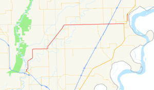
Arkansas Highway 140 is a state highway of 38.4 miles (61.8 km) in Arkansas.[1][2]
Route description
AR 140 begins at US 63 BUS in Marked Tree. It runs north with AR 14 until Lepanto, where the route crosses AR 135. AR 140 then heads northeast, briefly concurring with AR 136 and AR 181 individually before crossing under Interstate 55.
The route continues east to Osceola, meeting US 61. AR 140 continues alongside US 61 north to terminate at AR 158.
References
- ^ a b Arkansas State Highway and Transportation Department. AHTD Poinsett County map Retrieved on September 2 2009.
- ^ a b Arkansas State Highway and Transportation Department. AHTD Mississippi County map Retrieved on September 2, 2009.

