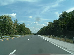
Ontario Highway 402
Template:Infobox Ontario road King's Highway 402, also known as Highway 402 and historically as the Blue Water Bridge Approach, is a 400-series highway in the Canadian province of Ontario which connects the Blue Water Bridge international crossing near Sarnia to Highway 401 in London. It is one of two vital trade links between Ontario and the Midwestern United States. It is a four-lane controlled access freeway for nearly its entire length, except on the approach to the Blue Water Bridge where it widens out. The only sizable community along Highway 402 between Sarnia and London is Strathroy.
Route description

The Blue Water Bridge crossing has 6 lanes of bridge traffic as well as non-stop freeway access, giving it an advantage over the busy Ambassador Bridge crossing at Windsor-Detroit which also suffers from 13 traffic lights leading up to the bridge. In addition, Highway 402 as a whole is built to higher safety standards and less congested than Highway 401. Across the Blue Water Bridge, Highway 402 continues in Michigan as Interstates 69 and 94 with Interstate 94 directly serving Detroit, Chicago, Milwaukee, and Minneapolis; and providing indirect links to Indianapolis, St. Louis, Kansas City, and Dallas. Meanwhile, Interstate 69 provides a direct link to Indianapolis and an indirect link to the Southeastern United States.
Highway 402 has Parclo A2 and B2 interchanges exclusively for its rural length, as well as a wide grass median. Within the City of Sarnia, any entry ramps to westbound 402 are signed as Bridge to the USA instead of Highway 402, since the freeway is rarely used as an urban commuter route. Truck lineups heading west towards the bridge have often stretched as far as the Oil Heritage Road (Exit 25).
Plans are underway to widen Highway 402 to six lanes within Sarnia in 2008. Due to extensive truck backups from the bridge crossing towards the USA, the westbound lanes will be widened by two lanes; eastbound capacity will remain as it is. The new four lane roadway will be divided into specific lanes for cars, trucks (two lanes), and local traffic.
History
Highway 402 was one of the original 400-series highways (the others being the QEW, Highway 400, and Highway 401). Known prior to that as the Blue Water Bridge Approach, Highway 402 was originally a short freeway that offered direct access to the bridge, bypassing the existing Highway 7 in Sarnia. Highway 402 terminated at an at-grade intersection with Lucasville Road and travellers continued onwards to London on Highway 7. In the 1960s, when the Highway 40 Sarnia Bypass was constructed, this junction was upgraded to an interchange.
Due to increased volumes of traffic on Highway 7, the rest of Highway 402 was constructed to link up with Highway 401 just outside of London, which substantially increased the highway's length. East of the Murphy Road overpass, Highway 402 was re-aligned to bypass the existing interchange with Highway 40; Exmouth Street was redirected to connect with Highway 7 at that junction, incorporating the bypassed alignment of old Highway 402. For the new Highway 402, a new overpass crossing was required with the then-CNR line (after the tracks were removed, it was renamed the Howard Watson Nature Trail) and a Parclo B4 interchange (very rare in Ontario) was constructed with the newly twinned Highway 40 just north of the existing interchange. The completion of the interchange with Front Street in 1982 (a Parclo AB, with the EB exit to Front Street also having a connector to Venetian Boulevard) removed the last at-grade intersection on Highway 402, making it a complete freeway from Highway 401 to the Blue Water Bridge.
However, the roadbed design had underestimated the volume of truck traffic and Highway 402 required extensive reconstruction in the mid-late 1990s, with traffic shifted onto one half of the highway so that the other could be rebuilt. In 1997, the Blue Water Bridge was twinned and sound barriers were added to the stretch between Christina Street and Modeland Road. Highway 7, the other existing provincial route between Sarnia and London was downloading to local authorities as London Line 22 around that time. Just outside London, new interchange ramps were added to the existing Wonderland Road overpass in 1998. In 2004, due to lineups leading to the bridge crossing, the speed limit was lowered to 70 km/h (45 mph) west of Airport Road.
Exit list
| Division | Location | Exit | Destinations | Notes | |
|---|---|---|---|---|---|
| Lambton | Point Edward | 1 | Front Street | Formerly Highway 40B | |
| Sarnia | 2 | Christina Street North | No eastbound exit | ||
| 3 | |||||
| 6 | |||||
| 9 | Airport Road | ||||
| Plympton-Wyoming | 15 | ||||
| 25 | Formerly Highway 21 south | ||||
| Warwick | 34 | Highway 21 was concurrent with Highway 402 west to Oil Heritage Road, prior to municipal downloading in 1997 | |||
| 44 | Formerly Highway 79 | ||||
| Middlesex | Adelaide-Metcalfe | 56 | |||
| 65 | Formerly` Highway 81 | ||||
| Strathroy-Caradoc | 69 | ||||
| 82 | |||||
| 86 | Formerly Highway 2 | ||||
| London | 98 | ||||
| 100 | Wonderland Road | Ramps added to existing overpass, interchange opened in 1998 | |||
| 103 | Eastbound exit and westbound entrance | ||||
