Bedford Air Force Station
Tools
Actions
General
Print/export
In other projects
Appearance
From Wikipedia, the free encyclopedia
This is an old revision of this page, as edited by Bwmoll3 (talk | contribs) at 23:57, 28 December 2010 (←Created page with '{{Infobox military structure |name=Bedford Air Force Station 60px |partof=Air Defense Command (ADC) |location= |coordinate...'). The present address (URL) is a permanent link to this revision, which may differ significantly from the current revision.
Bedford Air Force Station
 | |
|---|---|
| Part of Air Defense Command (ADC) | |
| Coordinates | 37°31′02″N 079°30′37″W / 37.51722°N 79.51028°W / 37.51722; -79.51028 (Bedford AFS M-121) |
| Type | Air Force Station |
| Site information | |
| Controlled by | United States Air Force |
| Site history | |
| Built | 1952 |
| In use | 1952-1965 |
| Garrison information | |
| Garrison | 649th Aircraft Control and Warning Squadron |
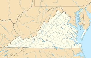
Location of Bedford AFS, Virginia
Map all coordinates using OpenStreetMap
Download coordinates as:
Bedford Air Force Station (ADC ID: M-121, NORAD ID: Z-24) is a closed United States Air Force General Surveillance Radar station. It is located 9.5 miles east of Buchanan Virginia. It was closed in 1975.
History
References
![]() This article incorporates public domain material from the Air Force Historical Research Agency
This article incorporates public domain material from the Air Force Historical Research Agency
External links
Hidden categories:
- Pages using gadget WikiMiniAtlas
- Pages using infobox military installation with unknown parameters
- Lists of coordinates
- Geographic coordinate lists
- Articles with Geo
- Portal templates with redlinked portals
- Pages with empty portal template
- Wikipedia articles incorporating text from the Air Force Historical Research Agency


