York South—Weston (federal electoral district)
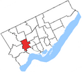
 York South–Weston in relation to the other Toronto ridings | |||
| Federal electoral district | |||
| Legislature | House of Commons | ||
| MP |
Liberal | ||
| District created | 1976 | ||
| First contested | 1979 | ||
| Last contested | 2008 | ||
| District webpage | profile, map | ||
| Provincial electoral district | |||
| Legislature | Legislative Assembly of Ontario | ||
| MPP |
Liberal | ||
| First contested | 1999 | ||
| Last contested | 2007 | ||
| Demographics | |||
| Population (2006) | 114,458 | ||
| Electors (2011) | 68,978 | ||
| Area (km²) | 26 | ||
| Pop. density (per km²) | 4,402.2 | ||
| Census division(s) | Toronto | ||
| Census subdivision(s) | Toronto | ||
York South—Weston is a federal and provincial electoral district in Ontario, Canada, that has been represented in the Canadian House of Commons since 1979, and in the Legislative Assembly of Ontario since 1999 [1].
Its federal Member of Parliament for the riding is Liberal Alan Tonks and its provincial Member of Provincial Parliament is Liberal Laura Albanese.
Federal electoral district
It is in the west-end of Toronto. The riding has a largely working class and immigrant population. The riding is made up largely of the old City of York, a southwestern portion of the old city of North York, and parts of the old city of Toronto north of High Park[1].
It consists of the part of the City of Toronto bounded by a line drawn from Humber River east along Highway 401, south along the Canadian National Railway situated west of Caledonia Road, west along Rogers Road, southeast along Old Weston Road, west along Lavender Road, south along Keele Street, southeast along the Canadian National/Canadian Pacific Railway, west along the Canadian Pacific Railway, and north along the Humber River to Highway 401[1].
Former boundaries
It was created in 1976 from parts of York South, York West, Davenport, High Park—Humber Valley, and Etobicoke ridings [1].
It consisted originally of the part of Metropolitan Toronto bounded by a line drawn from Eglinton Avenue West north along Keele Street, west along Lawrence Avenue West, south along the Humber River, east and north along the north limit of the City of Toronto, south along Runnymede Road, east along Annette Street, south along Keele Street, east along Humberside Avenue, northwest along the Canadian National Railway, east along the north limit of the City of Toronto, north along the east side of Prospect Cemetery, and west along Eglinton Avenue West to Keele Street[1].
In 1987, it was redefined to consist of the parts of the cities of North York, Toronto and York bounded by a line drawn from the western limit of the City of North York east along Highway 401, south along Keele Street, west along Eglinton Avenue West, south along Keele Street, west along the southern limit of the City of York, southeast along the Canadian National Railway line, west along Dupont Street, northwest along Dundas Street West, west along Annette Street, north along Runnymede Road, west along the Canadian Pacific Railway line, and north along the western limits of the Cities of York and North York to Highway 401[1].
In 1996, it was redefined to consist of the parts of the cities of North York, Toronto and York bounded by a line drawn from the western limit of the City of North York east along Highway 401, southeast along the Canadian National Railway situated immediately west of Caledonia Road, west along Rogers Road, south along Old Weston Road, west along the northern limit of the City of Toronto, southeast along the Canadian National Railway, west along the Canadian Pacific Railway, and north along the western limit of the cities of York and North York to Highway 401[1].
In 2003, it was given its current boundaries as described above.
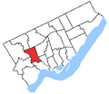
-
1976 to 1987
-
1987 to 1996
-
1996 to 2003
Members of Parliament
This riding has elected the following members of the Canadian House of Commons:
| Parliament | Years | Member | Party | |
|---|---|---|---|---|
| York South, York West, Davenport, High Park—Humber Valley, and Etobicoke prior to 1976 | ||||
| 31st | 1979-1980 | rowspan="2" Template:Canadian politics/party colours/Liberal | | Ursula Appolloni | Liberal |
| 32nd | 1980-1984 | |||
| 33rd | 1984-1988 | rowspan="3" Template:Canadian politics/party colours/Liberal | | John Nunziata | Liberal |
| 34th | 1988-1993 | |||
| 35th | 1993-1996 | |||
| 1996-1997 | rowspan="2" Template:Canadian politics/party colours/Independents | | Independent | ||
| 36th | 1997-2000 | |||
| 37th | 2000-2004 | rowspan="4" Template:Canadian politics/party colours/Liberal | | Alan Tonks | Liberal |
| 38th | 2004-2006 | |||
| 39th | 2006-2008 | |||
| 40th | 2008-present | |||
Federal elections results
Template:CanElec2 Template:CanElec2Row Template:CanElec2Row Template:CanElec2Row Template:CanElec2Row Template:CanElec2Tot
|} Source: Election Prediction Project
Template:CanElec2 Template:CanElec2Row Template:CanElec2Row Template:CanElec2Row Template:CanElec2Row Template:CanElec2Totexp Template:CanElec2Tot Template:CanElec2Tot
|}
Template:Canadian federal election, 2006/Electoral District/York South—Weston
Template:CanElec4 Template:CanElec4Row Template:CanElec4Row Template:CanElec4Row Template:CanElec4Row Template:CanElec4Row Template:CanElec4Tot
|} Note: Conservative vote is compared to the total of the Canadian Alliance vote and Progressive Conservative vote in 2000 election.
Template:CanElec4 Template:CanElec4Row Template:CanElec4Row Template:CanElec4Row Template:CanElec4Row Template:CanElec4Row Template:CanElec4Row Template:CanElec4Row Template:CanElec4Row Template:CanElec4Tot
|} Note: Canadian Alliance vote is compared to the Reform vote in 1997 election.
Template:CanElec4 Template:CanElec4Row Template:CanElec4Row Template:CanElec4Row Template:CanElec4Row Template:CanElec4Row Template:CanElec4Row Template:CanElec4Row Template:CanElec4Row Template:CanElec4Tot
|}
Template:CanElec4 Template:CanElec4Row Template:CanElec4Row Template:CanElec4Row Template:CanElec4Row Template:CanElec4Row Template:CanElec4Row Template:CanElec4Row Template:CanElec4Row Template:CanElec4Row Template:CanElec4Row Template:CanElec4Row Template:CanElec4Tot
|}
Template:CanElec4 Template:CanElec4Row Template:CanElec4Row Template:CanElec4Row Template:CanElec4Row Template:CanElec4Row Template:CanElec4Row Template:CanElec4Tot
|}
Template:CanElec4 Template:CanElec4Row Template:CanElec4Row Template:CanElec4Row Template:CanElec4Row Template:CanElec4Row Template:CanElec4Row Template:CanElec4Tot
|}
Template:CanElec4 Template:CanElec4Row Template:CanElec4Row Template:CanElec4Row Template:CanElec4Row Template:CanElec4Row Template:CanElec4Row Template:CanElec4Tot
|}
Template:CanElec5 Template:CanElec5Row Template:CanElec5Row Template:CanElec5Row Template:CanElec5Row Template:CanElec5Row Template:CanElec5Tot
|}
Provincial electoral district
The provincial electoral district was created in 1999 when provincial ridings were defined to have the same borders as federal ridings. New electoral district boundaries will follow the current federal boundaries that were in place for the 2004 and 2006 elections. They became law after Bill 214 (2005), otherwise known as the "Representations Act, 2005",was passed in the Ontario Legislature[2]. The October 10, 2007 Ontario general election was conducted using the new boundaries, with only minor changes to the boundaries in the south-east corner of the riding, along the border with the Davenport riding [3].
1999 Provincial electoral district description
YORK SOUTH-WESTON consisting of those parts of the cities of North York, Toronto and York described as follows: commencing at the intersection of the westerly limit of the City of North York with the Macdonald-Cartier Freeway (Highway No. 401); thence easterly along the Macdonald-Cartier Freeway to the Canadian National Railway situated immediately west of Caledonia Road; thence southerly along said railway to Rogers Road; thence westerly along Rogers Road to Old Weston Road; thence southerly along Old Weston Road to the northerly limit of the City of Toronto; thence westerly along the northerly limit of the City of Toronto to the Canadian National Railway; thence southeasterly along said railway to the Canadian Pacific Railway; thence westerly along the Canadian Pacific Railway to the westerly limit of the City of York; thence generally northerly along the westerly limit of the cities of York and North York to the point of commencement [4].
Member of Provincial Parliament
This riding has elected the following member of the Legislative Assembly of Ontario:
| Parliament | Years | Member | Party | |
|---|---|---|---|---|
| 39th | 1999 – 2003 | rowspan="2" Template:Canadian politics/party colours/Liberal | | Joe Cordiano | Liberal |
| 40th | 2003 – 2007 | |||
| 2007 | Template:Canadian politics/party colours/NDP | | Paul Ferreira | NDP | |
| 41st | 2007 - present | Template:Canadian politics/party colours/Liberal | | Laura Albanese | Liberal |
Provincial general election results
| Ontario electoral reform referendum, 2007 | |||
|---|---|---|---|
| Side | Votes | % | |
| First Past the Post | 16,842 | 56.4% | |
| Mixed member proportional | 12,998 | 43.6% | |
|- Template:Ontario elections/Liberals |Laura Albanese |align="right"|13,812 |align="right"|42.9% |align="right"|+1.5% |- Template:Ontario elections/NDP |Paul Ferreira |align="right"|13,343 |align="right"|41.4% |align="right"|-1.9% |- Template:Ontario elections/Progressive Conservatives |Karen McMillan-Aver |align="right"|3,249 |align="right"|10.1% |align="right"|-0.2% |- Template:Ontario elections/Green |Anthony Gratl |align="right"|1,225 |align="right"|3.8% |align="right"| +2.4% |- Template:Ontario elections/Libertarian |Marco Dias |align=right|382 |align=right|1.2% |align=right| |- Template:Ontario elections/FCP |Mariangela Sanabria |align=right|214 |align=right|0.7% |align=right|0.0% |}
Template:Canadian politics/party colours/NDP/rowTemplate:Canadian politics/party colours/Liberal/rowTemplate:Canadian politics/party colours/Progressive Conservatives/rowTemplate:Canadian politics/party colours/Green/rowTemplate:Canadian politics/party colours/Independents/rowTemplate:Canadian politics/party colours/Independents/rowTemplate:Canadian politics/party colours/Family Coalition/rowTemplate:Canadian politics/party colours/Libertarian/rowTemplate:Canadian politics/party colours/Freedom/row| By-election, February 8, 2007 | |||||
|---|---|---|---|---|---|
| Party | Candidate | Votes | % | +/- | |
| New Democrat | Paul Ferreira | 8,188 | 43.3% | +24.0% | |
| Liberal | Laura Albanese | 7,830 | 41.4% | -20.2% | |
| Progressive Conservative | Pina Martino | 1,941 | 10.3% | -4.9% | |
| Green | Mir Kamal | 262 | 1.4% | -1.1% | |
| Independent | Kevin Clarke | 220 | 1.2% | - | |
| Independent | Mohammed Choudhary | 142 | 0.8% | - | |
| Family Coalition | Mariangela Sanabria | 139 | 0.7% | -0.8% | |
| Libertarian | Nunzio Venuto | 98 | 0.5% | - | |
| Freedom | Wayne Simmons | 77 | 0.4% | - | |
| Ontario general election, 2003 | |||||
|---|---|---|---|---|---|
| Party | Candidate | Votes | % | +/- | |
| Liberal | Joseph Cordiano | 19,932 | 61.6% | +8.2% | |
| New Democrat | Brian Donlevy | 6,247 | 19.3% | -0.8% | |
| Progressive Conservative | Stephen Halicki | 4,930 | 15.2% | -6.7% | |
| Green | Enrique Palad | 794 | 2.5% | +2.0% | |
| Family Coalition | Mariangela Sanabria | 475 | 1.5% | -0.1% | |
| Ontario general election, 1999 | |||||
|---|---|---|---|---|---|
| Party | Candidate | Votes | % | +/- | |
| Liberal | Joseph Cordiano | 18,205 | 53.4% | ||
| Progressive Conservative | Alan Hofmeister | 7,471 | 21.9% | ||
| New Democrat | Rosana Pellizzari | 6,850 | 20.1% | ||
| Family Coalition | Enzo Granzotto | 542 | 1.6% | ||
| Independent | David Gershuny | 486 | 1.4% | ||
| Communist | Hassan Husseini | 261 | 0.8% | ||
| Green | Alma Subasic | 147 | 0.4% | ||
| Natural Law | Erica Kindl | 139 | 0.41 | ||
References
- ^ a b c d e f g "York South Weston electoral boundaries" (HTML). Elections Canada, Government of Canada. 2007. Retrieved 2007-01-29.
{{cite web}}: Cite has empty unknown parameter:|coauthors=(help) - ^ "Bill 214 2005 An Act to amend the Election Act,the Election Finances Act and the Legislative Assembly Act, to repeal the Representation Act, 1996 and to enact the Representation Act, 2005". Journals and Procedural Research Branch Office of the Legislative Assembly of Ontario. 2006. Archived from the original (HTML) on 2006-12-14. Retrieved 2007-01-29.
{{cite web}}: Cite has empty unknown parameter:|coauthors=(help) - ^ "New electoral boundaries". Elections Ontario, Government of Ontario. 2005. Archived from the original (HTML) on 2006-12-08. Retrieved 2007-01-19.
{{cite web}}: Cite has empty unknown parameter:|coauthors=(help) - ^ "York South Weston electoral boundaries" (HTML). Elections Canada, Government of Canada. 1996. Retrieved 2007-01-29.
{{cite web}}: Cite has empty unknown parameter:|coauthors=(help)
See also
- List of Canadian federal electoral districts
- Past Canadian electoral districts
- Campaign expense data from Elections Canada
External links
- York South-Weston history from the Parliament of Canada website includes election results and evolving boundary descriptions.


