Belm
Appearance
Belm | |
|---|---|
Location of Belm within Osnabrück district  | |
| Country | Germany |
| State | Lower Saxony |
| District | Osnabrück |
| Subdivisions | 5 |
| Government | |
| • Mayor | Bernhard Wellmann (CDU) |
| Area | |
• Total | 46.67 km2 (18.02 sq mi) |
| Elevation | 81 m (266 ft) |
| Population (2022-12-31)[1] | |
• Total | 14,095 |
| • Density | 300/km2 (780/sq mi) |
| Time zone | UTC+01:00 (CET) |
| • Summer (DST) | UTC+02:00 (CEST) |
| Postal codes | 49191 |
| Dialling codes | 05406 |
| Vehicle registration | OS |
| Website | www.belm.de |
Belm is a municipality in the district of Osnabrück, in Lower Saxony, Germany. It is situated in the Wiehengebirge, approx. 7 km northeast of Osnabrück and is therefore part of the city-agglomeration of Osnabrück. Also it is seated in the middle of the TERRA.vita Nature Park. Two little right tributaries of the river Hase are flowing through its territory.
The municipality is divided into 5 boroughs: Belm, Powe, Icker, Haltern and Vehrte
-
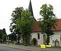
Catholic romanesque church St. Dionysius (built between 1230 and 1250) in Belm
-
Protestant Christchurch in Belm, built from 1815 to 1819
-
Old water mill, founded approx. 840[2] in Belm
-
Old railway station of Vehrte
-
Megalithic chambered tomb "devil's backing oven" in Vehrte
-
Erratic Block "Devil's Stone" in Vehrte
-
Feeder beck of the river Nette in Vehrte
-
Dolina "Icker Loch" in Icker
-
Megalithic chambered tomb "Sloopsteine of Haltern"]]
International relations
Belm is twinned with:
References


![Old water mill, founded approx. 840[2] in Belm](/upwiki/wikipedia/commons/thumb/6/66/Belm_alte_muehle_am_tie.jpg/120px-Belm_alte_muehle_am_tie.jpg)


![Megalithic chambered tomb "Sloopsteine of Haltern"]]](/upwiki/wikipedia/commons/thumb/0/01/Haltern_sloopsteine_05.jpg/120px-Haltern_sloopsteine_05.jpg)
