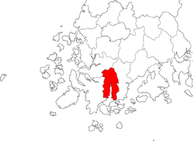
Gangjin County
Gangjin
강진 | |
|---|---|
| Korean transcription(s) | |
| • Hangul | 강진군 |
| • Hanja | 康津郡 |
| • Revised Romanization | Gangjin-gun |
| • McCune-Reischauer | Kangjin-gun |
 | |
| Country | |
| Region | Honam |
| Administrative divisions | 1 eup, 10 myeon |
| Area | |
• Total | 495.98 km2 (191.50 sq mi) |
| Population (2001) | |
• Total | 49,254 |
| • Density | 99.3/km2 (257/sq mi) |
| • Dialect | Jeolla |
Gangjin County (Gangjin-gun) is a county in South Jeolla Province, South Korea. Gangjin county proper was established in 1895. The county office is located in Gangjin-eup.
It is a noted area for the production of traditional Korean celadon. Additionally, it is the birthplace of Korean poet Yeongrang Kim Yun-sik, famous for his work in the 1930s and 1940s in the Jeolla dialect.
The county bird is the magpie. The county flower is the camellia, and the county tree is the ginkgo. There are also two mascots, Gang and Jin, who represent fire and water, respectively, and who appear throughout the county on signs and sidewalks.
A small portion of Wolchulsan National Park is located in Gangjin County.
There is a monument to 17th-century Dutch explorer Hendrick Hamel, the first westerner to experience and write about Korea's Joseon Dynasty era. Hamel and his men were shipwrecked on Jeju island, and they remained captives in Korea for 13 years.
Other Places of Interest
- Gangjinman Bay, in Maryang-myeon.
- Geumgok Temple (금곡사), in Gangjin-eup.
- Baekryeon Temple (백련사), in Doam-myeon.
- Mt. Su-in (수인산), 561 meters, in Byeongyeong-myeon.
- Boeunsan (보은산), 439 meters, in Gangjin-eup


