Surgut
Surgut
Сургут | |
|---|---|
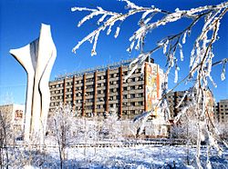
 Surgut in winter | |
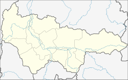
| Coordinates: 61°15′0″N 73°26′0″E / 61.25000°N 73.43333°E | |
| Country | Russia |
| Federal subject | Khanty-Mansi Autonomous Okrug |
| Founded | 1594 |
| Government | |
| • Body | Surgut City Duma |
| • Mayor | Dmitry Popov |
| Area | |
• Total | 219.92 km2 (84.91 sq mi) |
| Elevation | 40 m (130 ft) |
| Population | |
• Total | 306,700 |
| • Rank | 62nd in 2010 |
| • Density | 1,400/km2 (3,600/sq mi) |
| • Urban okrug | Surgut Urban Okrug |
| Time zone | UTC+5 (MSK+2 |
| Postal code(s)[3] | |
| Dialing code(s) | +7 3462 |
| OKTMO ID | 71876000001 |
| Website | www |

Surgut (Template:Lang-ru) is a city in Russia, on the Ob River near its junction with the Irtysh River, the largest in Khanty-Mansi Autonomous Okrug and second largest in Tyumen Oblast. Surgut was founded in 1594 by order of Tsar Feodor I and is one of the oldest in Siberia. The name of the city, according to one tradition, originates from the Khanty words "sur" (fish) and "gut" (hole, pit). Population: 306,700 (2010 Census);[1] 285,027 (2002 Census);[4] 247,823 (1989 Soviet census).[5]
The urbanization of Surgut took place in the 1960s, when it became a center of oil and gas production. On June 25, 1965 the work settlement of Surgut was granted town status. The city's holiday is celebrated annually on June 12. The current mayor is Dmitry Valeryevich Popov (since 2010). Ex-mayor Alexander Sidorov (since 1996) oversaw the construction of the Surgut Bridge, the longest one-tower cable-stayed bridge in the world.
Economy
Surgut's economy is tied to oil production (the city is known as "The Oil Capital of Russia") and the processing of natural gas. The most important enterprises are the oil firm Surgutneftegaz (often known as Surgut) and Surgutgazprom (a unit of Gazprom). Surgut electric plants GRES-1 and GRES-2 produce over 7200 megawatts and supply most of the region with relatively cheap electricity.
Sport
- Universitet Surgut - basketball team in the Russian Basketball Super League
Transport
The city is served by Surgut Airport, which offers flights to Moscow, Saint Petersburg, Dubai, Irkutsk, and a number of other cities.
The Tyumen–Novy Urengoy railway line passes near the city. Going towards Tyumen, the next station is Salym, where Royal Dutch Shell has a substantial development. This section of the route takes about six hours. Road P-404 connects Surgut with Tyumen.
There is a port on the Ob river.
International relations
Twin towns/sister cities
Surgut is twinned with:
 Katerini, Greece.
 Sioux Falls, South Dakota, United States.
 Zalaegerszeg, Hungary.
 Ivano-Frankivsk, Ukraine[6]
See also
References
- ^ a b Russian Federal State Statistics Service (2011). Всероссийская перепись населения 2010 года. Том 1 [2010 All-Russian Population Census, vol. 1]. Всероссийская перепись населения 2010 года [2010 All-Russia Population Census] (in Russian). Federal State Statistics Service.
- ^ "Об исчислении времени". Официальный интернет-портал правовой информации (in Russian). 3 June 2011. Retrieved 19 January 2019.
- ^ Почта России. Информационно-вычислительный центр ОАСУ РПО. (Russian Post). Поиск объектов почтовой связи (Postal Objects Search) (in Russian)
- ^ a b Federal State Statistics Service (21 May 2004). Численность населения России, субъектов Российской Федерации в составе федеральных округов, районов, городских поселений, сельских населённых пунктов – районных центров и сельских населённых пунктов с населением 3 тысячи и более человек [Population of Russia, Its Federal Districts, Federal Subjects, Districts, Urban Localities, Rural Localities—Administrative Centers, and Rural Localities with Population of Over 3,000] (XLS). Всероссийская перепись населения 2002 года [All-Russia Population Census of 2002] (in Russian). Cite error: The named reference "PopCensus" was defined multiple times with different content (see the help page).
- ^ Всесоюзная перепись населения 1989 г. Численность наличного населения союзных и автономных республик, автономных областей и округов, краёв, областей, районов, городских поселений и сёл-райцентров [All Union Population Census of 1989: Present Population of Union and Autonomous Republics, Autonomous Oblasts and Okrugs, Krais, Oblasts, Districts, Urban Settlements, and Villages Serving as District Administrative Centers]. Всесоюзная перепись населения 1989 года [All-Union Population Census of 1989] (in Russian). Институт демографии Национального исследовательского университета: Высшая школа экономики [Institute of Demography at the National Research University: Higher School of Economics]. 1989 – via Demoscope Weekly.
- ^ "Офіційний сайт міста Івано-Франківська". mvk.if.ua (in Ukrainian). Retrieved 7 March 2010.
External links
This article's use of external links may not follow Wikipedia's policies or guidelines. (August 2009) |


