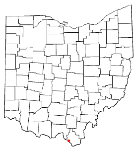
Ironton, Ohio
Ironton is a city located in Lawrence County, Ohio, along the Ohio River. As of the 2000 census, the city had a total population of 11,211. It is the county seat of Lawrence CountyTemplate:GR.
Ironton is a part of the Huntington-Ashland, WV-KY-OH, Metropolitan Statistical Area (MSA). As of the 2000 census, the MSA had a population of 288,649.
History
Ironton was choosen for a city due to its position on the river and the slope of the land itself. In a very short time between 1850-1890 Ironton became one of the finest producers of Iron in the world. England, France, and Russia all purchased iron for warships from here due to the quality. At one time some of the most oppulant homes in the midwest were located here. This was due to the great wealth that was generated by the "iron masters". As many as twenty furances were in operation at the peak of production sometime in the late 19th century. With wealth came many new residents and new industries such as soap and nail production. Ironton even had a railroad named after it. The DT&I (Detroit, Toledo, and Ironton Rail Road) operated between Detroit and Ironton. Ironton also became known for its lax attitude towards sin and vice. Ironton was home to a racetrack, many saloons and brothels, and even the occasional broadway show down from New York. Ironton often became the destination of choice to those in the area for recreation and quick and quiet marriages. It could be said that Ironton was a 19th century Las Vegas although the city did not contain any legalized gambling.
The downfall however came as the market for Iron changed. The quality of the iron that had once made Ironton one of the leading producers of "pig iron" was no longer considered as desirable. All of the easily accassable iron (close to the surface) had been mined by 1899 and at this point the continued production costs began to outweigh the benefit. After an nationwide economic recession\depression in the late 19th century Ironton was no longer growing. The great depression on the late thirties, and two major floods (1917,1937) devestated the city to the point that most if not all the cities industires had closed down for good. Continued decline was the story for the city for the next seventy years. The continued dependency on labor industries have severly hurt the region as a whole but Ironton even more so. By 2004 Ironton and the county itself had shrunk to the point where there were less people living in the whole county than had lived in the city of Ironton 110 years before.
Notable places and events
Ironton was a stop along the Underground railroad
Iron mined in the area was used for the Ironclad "Monitor"
Several presidents, including George W Bush have visted the city
Geography

Ironton is located at 38°31'51" North, 82°40'42" West (38.530720, -82.678309)Template:GR.
According to the United States Census Bureau, the city has a total area of 11.4 km² (4.4 mi²). 10.7 km² (4.1 mi²) of it is land and 0.7 km² (0.3 mi²) of it is water. The total area is 5.91% water.
Demographics
As of the censusTemplate:GR of 2000, there were 11,211 people, 4,906 households, and 3,022 families residing in the city. The population density was 1,048.1/km² (2,711.3/mi²). There were 5,507 housing units at an average density of 514.8/km² (1,331.8/mi²). The racial makeup of the city was 93.33% White, 5.24% African American, 0.09% Native American, 0.25% Asian, 0.02% Pacific Islander, 0.09% from other races, and 0.99% from two or more races. 0.51% of the population were Hispanic or Latino of any race.
There were 4,906 households out of which 25.9% had children under the age of 18 living with them, 43.6% were married couples living together, 14.3% had a female householder with no husband present, and 38.4% were non-families. 35.3% of all households were made up of individuals and 18.0% had someone living alone who was 65 years of age or older. The average household size was 2.22 and the average family size was 2.85.
In the city the population was spread out with 21.8% under the age of 18, 7.9% from 18 to 24, 24.6% from 25 to 44, 24.5% from 45 to 64, and 21.2% who were 65 years of age or older. The median age was 42 years. For every 100 females there were 82.2 males. For every 100 females age 18 and over, there were 77.0 males.
The median income for a household in the city was $23,585, and the median income for a family was $35,014. Males had a median income of $31,702 versus $24,190 for females. The per capita income for the city was $15,391. 23.1% of the population and 17.2% of families were below the poverty line. 32.4% of those under the age of 18 and 17.0% of those 65 and older were living below the poverty line.
Education
Ohio University Southern Campus is located in Ironton.
