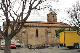
Puimoisson
Appearance
You can help expand this article with text translated from the corresponding article in French. (December 2008) Click [show] for important translation instructions.
|
Puimoisson | |
|---|---|
 | |
| Country | France |
| Region | Provence-Alpes-Côte d'Azur |
| Department | Alpes-de-Haute-Provence |
| Arrondissement | Digne-les-Bains |
| Canton | Riez |
| Government | |
| • Mayor (2008–2014) | Robert Biglia |
Area 1 | 35.44 km2 (13.68 sq mi) |
| Population (2008) | 698 |
| • Density | 20/km2 (51/sq mi) |
| Time zone | UTC+01:00 (CET) |
| • Summer (DST) | UTC+02:00 (CEST) |
| INSEE/Postal code | 04157 /04410 |
| Elevation | 567–781 m (1,860–2,562 ft) (avg. 698 m or 2,290 ft) |
| 1 French Land Register data, which excludes lakes, ponds, glaciers > 1 km2 (0.386 sq mi or 247 acres) and river estuaries. | |
Puimoisson is a commune in the Alpes-de-Haute-Provence department in southeastern France.
Population
| Year | 1765 | 1793 | 1800 | 1806 | 1821 | 1831 | 1836 | 1841 | 1846 | 1851 |
|---|---|---|---|---|---|---|---|---|---|---|
| Population | 412 | 1527 | 1600 | 1386 | 1303 | 1357 | 1312 | 1178 | 1185 | 1161 |
| Year | 1856 | 1861 | 1866 | 1872 | 1876 | 1881 | 1886 | 1891 | 1896 | 1901 |
|---|---|---|---|---|---|---|---|---|---|---|
| Population | 1114 | 1164 | 1164 | 1160 | 1050 | 1041 | 975 | 908 | 903 | 802 |
| Year | 1906 | 1911 | 1921 | 1926 | 1931 | 1936 | 1946 | 1954 | 1962 | 1968 |
|---|---|---|---|---|---|---|---|---|---|---|
| Population | 790 | 792 | 664 | 625 | 600 | 560 | 583 | 522 | 473 | 508 |
| Year | 1975 | 1982 | 1990 | 1999 | 2008 |
|---|---|---|---|---|---|
| Population | 491 | 511 | 511 | 551 | 698 |
See also
References


