Uecker
| Uecker | |
|---|---|
 | |
 | |
| Physical characteristics | |
| Mouth | Szczecin Lagoon 53°45′4″N 13°4′16″E / 53.75111°N 13.07111°E |
| Length | 102 km |
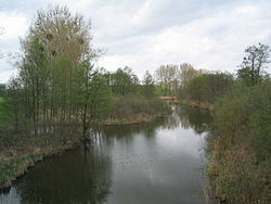
The Uecker or Ucker (Template:Lang-pl)[1] is a river in the northeastern German states of Brandenburg, where it is known as the Ucker, and of Mecklenburg-Vorpommern. Its source lies in the Uckermark district, near the village Alt-Temmen. It flows north through Lake Oberuckersee, Lake Mollensee and Lake Unteruckersee, where the old town of Prenzlau is situated. Near the small village of Nieden (the border between Brandenburg and Vorpommern) the Ucker changes its name to Uecker. It flows further north through the towns Pasewalk, Torgelow and passes Eggesin on the left site. Here the river Randow flows into the Uecker. In Ueckermünde, the Uecker flows into the Szczecin Lagoon, which is connected with the Baltic Sea through the three straits Peenestrom, Świna and Dziwna.
The name "Uecker" originated in the Polabian word vikru/vikrus, meaning "fast" or "quick".[2] The Uecker gave its name to the Uckermark historical region and to the two districts Uckermark and Uecker-Randow.
Notes
References
- Heinrich, Gerd (1973). Handbuch der historischen Stätten Deutschlands, Band 10, Berlin und Brandenburg. Stuttgart: Alfred Kröner Verlag. p. 563. ISBN 978-3-520-31103-0. Template:De icon
- Leciejewicz, Lech (1989). Słowianie zachodni : z dziejów tworzenia się średniowiecznej Europy. Wrocław: Zakład Narodowy im. Ossolińskich. ISBN 83-04-02690-2. Template:Pl icon
