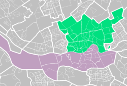
Rotterdam Rechter Maasoever
Appearance
Rechter Maasoever | |
|---|---|
 | |
| Country | Netherlands |
| Municipality | Rotterdam |
| Population (2008) | 343,580 |
Rotterdam Rechter Maasoever (Rotterdam right bank of the Maas/ Northern Rotterdam) includes the part of Rotterdam, which is north of the Nieuwe Maas. The city of Rotterdam is created north of the river and attends the majority of the population (approximately 60%) north of the river.
Boroughs and neighborhoods
Rechter Maasoever is no separate administrative unit, but consists of seven complete municipalities which can be further be divided into areas:
Hospitals
- Erasmus MC
- Havenziekenhuis
- Oogziekenhuis
- Sint Franciscus Gasthuis
Stations
There are four train stations situated at the Rechter Maasoever: Alexander Station, Blaak Station, Centraal Station and Noord Station.
See also
- Rotterdam Linker Maasoever (Left bank of the Maas)
