Wild Basin, Rocky Mountain National Park


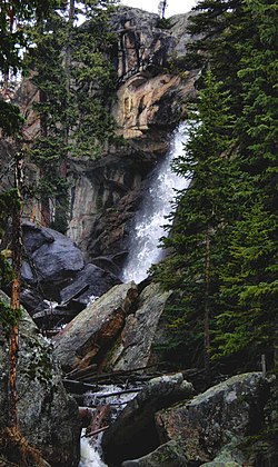
Wild Basin is a scenic trail and the southeastern entrance station of Rocky Mountain National Park in Colorado. It is located north of Allenspark off State Highway 7. A dirt road leads to a ranger station, parking and horseback or hiking trails. The trail to Bluebird Lake and Ouzel Lake follows the North St. Vrain Creek (which is a tributary to the South Platte River)[1] passing Calypso Cascades and Ouzel Falls along the way, leading to Ouzel Lake and Bluebird Lake. Both Ouzel Falls and Ouzel Lake are named after a North American species of bird, Cinclus mexicanus, also known as a dipper [2]. Other trails lead to Thunder Lake, Finch Lake, and Pear Lake. Note that there is only one main road through the park, it was paved in six years by 35 convicts.
See also
Notes
References
- Chronic, Halka and Williams, Felicie; Roadside Geology of Colorado: Second Edition; Copyright 2002 by Halka Chronic and Felicie Williams; Mountain Press Publishing Company; ISBN 0-87842-447-4
- Dannen, Kent and Donna; Hiking Rocky Mountain National Park: Including Indian Peaks Wilderness: Ninth Edition; The Globe Pequot Press; Copyright 1978, 80 82 83, 85, 89, 94, 2002 by The Globe Pequot Press; ISBN 0-7627-2245-2
External links
