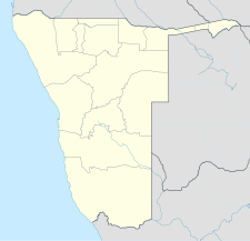
Arandis Airport
Appearance
Arandis Airport | |||||||||||
|---|---|---|---|---|---|---|---|---|---|---|---|
| Summary | |||||||||||
| Airport type | Public | ||||||||||
| Operator | Private | ||||||||||
| Serves | Arandis, Namibia | ||||||||||
| Elevation AMSL | 1,905 ft / 581 m | ||||||||||
| Coordinates | 22°27′44″S 014°58′48″E / 22.46222°S 14.98000°E | ||||||||||
 | |||||||||||
| Runways | |||||||||||
| |||||||||||
Arandis Airport (IATA: ADI, ICAO: FYAR) is an airport serving Arandis, a town in the Erongo Region of Namibia. The airport is about 5 km (3 mi) south of the center of Arandis.[3] The town and airport also provide service to the Rössing Uranium Mine, one of the world's largest open-pit uranium mines.
Facilities
The airport resides at an elevation of 1,905 feet (581 m) above mean sea level. It has one runway designated 10/28 with an asphalt surface measuring 1,920 by 20 metres (6,299 ft × 66 ft).[1]
References
- ^ a b Airport information for FYAR from DAFIF (effective October 2006)
- ^ Airport information for ADI at Great Circle Mapper. Source: DAFIF (effective October 2006).
- ^ "Distance and heading from Arandis to airport". WikiMapia. Archived from the original on 17 February 2010. Retrieved 18 Feb 2010.
{{cite web}}: Unknown parameter|deadurl=ignored (|url-status=suggested) (help)
External links

