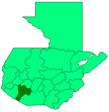
Suchitepéquez Department
Appearance

Suchitepéquez is one of the 22 departments of Guatemala. Its capital is Mazatenango. It is situated in the southwestern region of Guatemala, limiting to the north with Quetzaltenango, Sololá and Chimaltenango, to the south with the Pacific Ocean, to the east with Escuintla, and to the west with Retalhuleu.
Municipalities
- Chicacao
- Cuyotenango
- Mazatenango
- Patulul
- Pueblo Nuevo
- Río Bravo
- Samayac
- San Antonio Suchitepéquez
- San Bernardino
- San Francisco Zapotitlán
- San Gabriel
- San José El Idolo
- San Juan Bautista
- San Lorenzo, Suchitepéquez
- San Miguel Panán
- San Pablo Jocopilas
- Santa Bárbara
- Santo Domingo Suchitepequez
- Santo Tomás La Unión
- Zunilito
References
Gall, Francis (1976). Diccionario Geográfico de Guatemala. 4 vols. Guatemala: Instituto Geográfico Nacional. {{cite book}}: Cite has empty unknown parameter: |coauthors= (help)

