Wikipedia:WikiProject Maps/Conventions/Area maps
| It has been suggested that Wikipedia:Distribution maps and Wikipedia:WikiProject_Maps/Conventions/Locator_maps_(blank) be merged into this page. (Discuss) |
This page provide conventions for wiki Area maps.
Area maps or Distribution maps display one or multiple entities on a map, and are closely link to Locator maps (blank) (mother) providing the background & Historical maps (daughter) providing conventions for associated labels, icons, and legend. Historical label/icons conventions may also be used for other purpose, such complex biology maps, etc. This page conventions apply to areas. For further icons and legend conventions, see Historical maps conventions.
These conventions for Area maps are often use to create basic Locator maps, or to display area of control by respective kingdoms/countries, plus some key points, and are actually the basis of more complex maps. You need this conventions when you start an explicative historical map. If you use these conventions to complete background such as topographic ones, apply a transparency of 30%.
Specific area maps
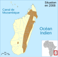
Locator maps/Single-area maps display an article's subject area of occupation in a larger context. These maps are often use to display : a country (red) in its region (map) and in the world (corner map) ; an animal range (red) in its context (country map, world map) ; language (red), people, kingdom in their wider context.
If the area of interest (subject) is really small part of the map, generally <10~20% of the landmass —the most common—, we have to use the red below to clearly enlighten this small area. If the area of interest is relatively wide, you are encouraged to use softer colors, some being suggested below.
Multi-areas maps/Complex maps display several areas of interest.
Semantic maps/Complex maps display one or several areas of interest, and may include icons, labels, legend, and a localizator (a small locator map). Being specificaly complex, please see Historical maps.
Convention
- Note: the Four color theorem state that if each area is contignous (one element), four colours are enough to create all the map, whatever the number of area is. Labels have to be use for such four color maps.
| Subject | Colorimetry (RGB/hex) |
|---|---|
| Point of interest (cities especially). | #B00000
R:176 G:0 B:0 |
| Area of interest (animal' range, etc). | #F07568
R:240 G:117 B:104 |
| Border colour for areas of interest. | #E0584E
R:224 G:88 B:78 |
| Parks or natural preservation areas. | #A0F090
R:160 G:240 B:144 |
| Colour 1 for four-colour maps (see note below). | #CEFEF2
R:206 G:254 B:242 |
| Additional colour 2 for four-colour maps. | #FFD0D0
R:255 G:208 B:208 |
| Additional colour 3 for four-colour maps. | #F8A20C
R:248 G:162 B:12 |
| Additional colour 4 for four-colour maps. | #3CE67B
R:60 G:230 B:123 |
|
Naming (upload):
For animals, use the binominal name. For others, use the English wiki article title. If need, add just after the subject name the section's name, the year, etc.
| |
Template
=> No SVG template available yet.
Gallery of examples
- Locator (filled)
-
Using "Location maps conventions" + the area coloration (red).
-
Using "Location maps conventions" + the area coloration (red).
-
India Andhra Pradesh locator map.svg
-
LocationVenezuela.svg
-
If based on English PNG conventions
-
if based on English SVG conventions
-
if based on German-French conventions


