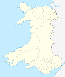
North Wales Path
The North Wales Path is a long distance walk of some 60 miles which runs close to the North Wales coast between Prestatyn in the east and Bangor in the west. Parts of it overlap with the Wales Coast Path.
Description
The route mostly follows exisiting public footpaths and is way-marked with its own logo. A brochure, containing a set of 8 maps, has been produced (on a scale of 1:25000) to indicate the route and places of interest. It also shows facilities such as toilets and car parks.

The path can easily be broken up into smaller, accessible sections, and many of these are well used. Popular sections include the Prestatyn-Dyserth Way, a former railway trackbed, the Great Orme and Little Orme at Llandudno, Mynydd y Dref (Conwy Mountain) between Conwy and Sychnant Pass, and Aber Falls.
Much of the route offers good views of the coast and the sea.
The Wales Coast Path, an 870 miles (1,400km) long-distance walking route around the whole coast of Wales from Chepstow to Queensferry,[1] also covers the North Wales coast. In places, both paths take the same route, but North Wales Path takes more detours inland while the Coast Path tends to keep as close as possible to the coast, as may be expected.
Offshoot Trails
There are a number of smaller trails very near the Coast Path, which often take users inland on shorter rutes; these include:
- Bryn Euryn Local Nature Reserve Walks. Bryn Euryn itself is a prominent limestone hill which overlooks the seaseide village of Rhos on Sea. The hill has both grassland and woodland, with part of it being a Site of Special Scientific Interest. Walkers pass Llys Euryn, a 15th century house and a 6th century hillfort.[2] Bryn Euryn is managed by Conwy Countryside Service. There are two trails: one surrounding the summit (1 mile in length) and the second being within the woodlands (1.5 miles circular walk). 26 different species of butterfly have been recorded on Bryn Euryn.
- Caerhun Walk. Starting at Tal-y-Cafn on the banks of the Conwy river, this walk is graded as easy, and users would visit on their way: Kanovium Roman fort, and Pontwgan and Tyn-y Groes villages. There are impressive views of Snowdonia and the Conwy Valley. The walk is 3 miles long with an optional extra 1.5 miles. This circular toor starts at Tal-y-Cafn (OS: SH 788717).
- Great Orme Summit Trails. There are three scenic walks from Llandudno to the summit. These are clearly waymarked on signs and take in stunning views of the town, the bay, the mountains of Snowdonia in the distance as well as the Menai Strait and Anglesey. All three are very steep in places. The "Haulfre Gardens Trail" is 1 mile in length and takes around an hour, the "Zig Zag Trail" is also 1 mile but takes half an hour longer and the "Happy Valley Trail" is 1.5 miles long and takes an hour and a half to complete.[3]
References
- ^ BBC News Wales - All-Wales coast path nears completion Retrieved 2 January 2012
- ^ Conwy County Council official website - Gwarchodfa natur leol BRYN EURYN local nature reserve Retrieved 12 August 2013
- ^ Conwy County Council official website - Llwybrau Copa'r Gogarth, Great Orm Summit Trails Retrieved 12 August 2013
See also
Long-distance footpaths in the UK

