Las Galeras
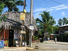
Las Galeras is a Dominican Municipal district of Santa Bárbara de Samaná, Samaná province. It is on the east coast of the Samaná Peninsula, on the Rincón Bay that is found between Cabrón and Samaná capes.

Las Galeras, in English The Galleys (a galley was a war ship where prisoners and slaves were used to move the ship), because two galleys stayed here during the 16th Century.[1]
Population
In the last national census (2002), the population of Las Galeras is included with that of Santa Bárbara de Samaná.[2]
Economy
The most important economic activities of the province are agriculture, fishing and tourism.
Tourism

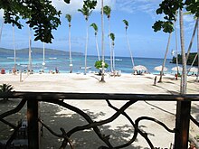
The region is famous for its beautiful palm beaches. There is a beach at the seafront of Las Galeras itself, as well as a white sand beach, Playa "La Playita" within walking distance from the town. Boat tours to Rincon beach (Playa Rincón) are available from the Las Galeras jetty.
References
- ^ Vega, Bernardo (2004). Breve historia de Samaná (in Spanish). Santo Domingo: Fundación Cultural Dominicana. 99934-27-06-03.
- ^ Censo 2002 de Población y Vivienda, Oficina Nacional de Estadistica
