Bergerac Dordogne Périgord Airport
Appearance
You can help expand this article with text translated from the corresponding article in French. (July 2014) Click [show] for important translation instructions.
|
Bergerac Dordogne Périgord Airport Aéroport de Bergerac Dordogne Périgord | |||||||||||||||
|---|---|---|---|---|---|---|---|---|---|---|---|---|---|---|---|
 | |||||||||||||||
| Summary | |||||||||||||||
| Airport type | Public | ||||||||||||||
| Operator | CCI de Dordogne | ||||||||||||||
| Serves | Bergerac, Dordogne, France | ||||||||||||||
| Elevation AMSL | 171 ft / 52 m | ||||||||||||||
| Coordinates | 44°49′28″N 000°31′14″E / 44.82444°N 0.52056°E | ||||||||||||||
| Website | bergerac.aeroport.fr | ||||||||||||||
| Maps | |||||||||||||||
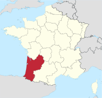
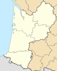
 Location of Aquitaine region in France | |||||||||||||||
 | |||||||||||||||
| Runways | |||||||||||||||
| |||||||||||||||
Bergerac Dordogne Périgord Airport (Template:Lang-fr) (IATA: EGC, ICAO: LFBE) is an airport serving Bergerac, a commune of the Dordogne department (formerly the Périgord province) in the Aquitaine region of France. The airport is located 3 kilometres (1.6 NM) south-southeast of Bergerac.[1][2] It is also known as Bergerac-Roumanière Airport.[1]
Facilities
The airport resides at an elevation of 52 metres (171 ft) above mean sea level. It has one paved runway designated 10/28 which measures 2,205 by 45 metres (7,234 ft × 148 ft). It also has a parallel unpaved runway with a grass surface measuring 770 by 60 metres (2,526 ft × 197 ft).[1]
Airlines and destinations
| Airlines | Destinations |
|---|---|
| Flybe | Southampton Seasonal: Birmingham, Edinburgh, Exeter, Manchester (begins 4 July 2015) |
| Jet2.com | Manchester |
| Ryanair | London-Stansted Summer seasonal: Bristol, Charleroi, East Midlands, Liverpool |
| Transavia.com | Rotterdam |
| Twin Jet | Paris-Orly |
References
- ^ a b c d LFBE – Bergerac Roumanière. AIP from French Service d'information aéronautique, effective 26 December 2024.
- ^ a b Template:Fr icon Aéroport de Bergerac Dordogne Périgord (EGC / LFBE) at Union des Aéroports Français
- ^ Airport information for LFBE from DAFIF (effective October 2006)
- ^ Airport information for EGC at Great Circle Mapper. Source: DAFIF (effective October 2006).
External links
- Template:Fr icon Aéroport de Bergerac Dordogne Périgord, official site
- Current weather for LFBE at NOAA/NWS
- Accident history for EGC at Aviation Safety Network
Wikimedia Commons has media related to Aéroport Bergerac Dordogne Périgord.

