Faribault, Minnesota
Faribault, Minnesota | |
|---|---|
| Nickname: Flambo | |
| Motto: City on the Move | |
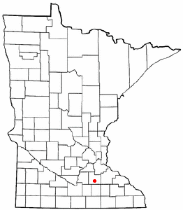
 Location in Rice County and the state of Minnesota. | |
| Country State Counties | United States Minnesota Rice |
| Government | |
| • Mayor | Charles Ackman (political party?) |
| Population (2000) | |
• Total | 20,818 |
| Time zone | UTC-6 (CST) |
| • Summer (DST) | UTC-5 (CDT) |
| Website | http://www.faribault.org |
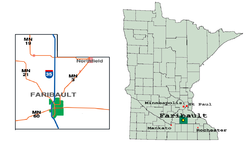
Faribault is a city in Rice County, Minnesota, United States. The population was 20,818 at the 2000 census. It is the county seat of Rice County6.
History
The Wahpekute band of Dakotah Indians inhabited the area since about 1750, prior to the arrival of white settlers.
The city traces its history to the establishment of a fur trading post by fur trader Alexander Faribault in 1826. Alexander Faribault was the son of a French fur trader and a woman of Dakota heritage, and had the language skills necessary to serve his varied clientele. The establishment of his trading post predated the presence of any form of state government or meaningful federal supervision.
The Alexander Faribault house was constructed in 1853. It was the first frame building to be constructed in what would become the city, and still stands today. Important milestones were reached in 1855 and 1856, with the streets platted, availability of mail service, and construction of several churches and a school occurring in quick succession.
Railroad service began in 1865.
The city was granted a home-rule charter in 1872.
The 1993 film, Grumpy Old Men, was shot in Faribault.
Notable Institutions
Several state-run institutions are located in Faribault, including a prison (a former mental hospital), School for the Blind and School for the Deaf.
On the bluffs overlooking the Straight River and the town of Faribault, Shattuck-Saint Mary's School (formerly Shattuck School (college prep for boys, grade 7-12), St. Mary's (college prep for girls, grade 7-12) and the now-closed St. James school for boys, grade 1-6)) now produces violinists and hockey players for orchestras and ice arenas around the world.
Shattuck was originally an Episcopal military school, evolved into more non-secular directions in the later 1970's when faced with a post-Vietnam hangover and a need to better utilize their indoor hockey arena after seeing the success of the local town hockey team, the now-defunct Faribault Butter Kernels.
Educational
Faribault Public Schools, Faribault Public School website
Minnesota State Academy for the Blind
Minnesota State Academy for the Deaf
Institutions
Faribault Correctional Facility
Prominent Individuals
Herbert Sellner was the inventor of the Tilt-A-Whirl carnival ride. As of 2004, the rides were still manufactured in Faribault.
Henry Benjamin Whipple was the first Episcopal bishop in Minnesota. He was an advocate for clemency for Dakota prisoners in the wake of the Sioux Uprising (also known as the Dakota War or Dakota Conflict) in 1862. He is buried beneath the altar of the Cathedral of Our Merciful Saviour in Faribault, the oldest cathedral in Minnesota.
Bruce Smith 1941 Heisman trophy winner
Stephen Chatman, a noted Canadian composer, was born in Faribault in 1950. Chatman's bio
Businesses
Faribault has the usual gamut of small-town retail and service shops. Major employers include a turkey packing plant and a frozen vegetable processing plant in town. Recently, Jim & Joe's Clothiers closed after 125+ years of service. A recent news article [1] tells the backstory.
Now with the Urban Growth Project, the city's future is going to be based with more businesses in the near future. The goal is to make more business possible with the city's taskforce.
Per Faribault's Jeffrey Sears, the finest pizza parlor in the world, Basilleo's Pizza, is located on Fourth Street.
Geography

According to the United States Census Bureau, the city has a total area of 33.3 km² (12.9 mi²). 32.8 km² (12.7 mi²) of it is land and 0.5 km² (0.2 mi²) of it (1.56%) is water.
The confluence of the Straight River and the Cannon River is located within city limits. Sakatah Lake State Park and Nerstrand-Big Woods State Park are nearby.
Faribault County, Minnesota, roughly 100 miles to the southwest, is unrelated to the city of Faribault.
Interstate 35 runs along the western edge of town. There are three exits. A truck stop, various restaurants and a motel serve motorists. For about 30 years, Interstate 35 was detoured directly through Faribault, including several stop lights on the actual interstate highway, allowing the Dairy Queen owner (amongst others) to enjoy significant sales revenue as tired and ice cream-starved travelers were forced to drive through Faribault (both directions) up and down the interstate. In approximately 1975, Interstate 35 was finally and correctly routed around Faribault (to the west) and pushed those once lucky food and fuel retailers back down from the sales stratosphere. The White Sands Swimming Pool ran along the same detoured road and for ten years (1965-1975), was the social epicenter for the tanned Faribault youth. Currently, only weeds and abandoned infrastructure remain where Minnesota's largest outdoor swimming pool once stood.
Demographics
The racial makeup of Faribault was almost exclusively white until about 1985, when Hispanic and Somali immigrants and their families began to settle in the area. These groups were drawn by the availabilitiy of employment to unskilled workers, and the relative absence of crime compared to larger cities. By 2000, there were churches and businesses catering to each of these racial groups.
As of the census² of 2000, there were 20,818 people, 7,472 households, and 4,946 families residing in the city. The population density was 634.9/km² (1,644.8/mi²). There were 7,668 housing units at an average density of 233.9/km² (605.8/mi²). The racial makeup of the city was 89.87% White, 2.69% African American, 0.67% Native American, 1.83% Asian, 0.06% Pacific Islander, 3.33% from other races, and 1.53% from two or more races. Hispanic or Latino of any race were 8.90% of the population.
There were 7,472 households out of which 34.7% had children under the age of 18 living with them, 50.3% were married couples living together, 11.3% had a female householder with no husband present, and 33.8% were non-families. 28.5% of all households were made up of individuals and 11.8% had someone living alone who was 65 years of age or older. The average household size was 2.53 and the average family size was 3.10.
In the city the population was spread out with 26.2% under the age of 18, 9.9% from 18 to 24, 30.7% from 25 to 44, 19.7% from 45 to 64, and 13.5% who were 65 years of age or older. The median age was 34 years. For every 100 females there were 106.8 males. For every 100 females age 18 and over, there were 106.6 males.
The median income for a household in the city was $40,865, and the median income for a family was $49,662. Males had a median income of $32,404 versus $24,046 for females. The per capita income for the city was $18,610. About 5.8% of families and 9.0% of the population were below the poverty line, including 7.9% of those under age 18 and 13.1% of those age 65 or over.
External links
- City of Faribault
- General information for City of Faribault (fbomn.com)
- [www.s-sm.org/ Shattuck-St. Mary's School]
- Minnesota State Academy for the Deaf (MSAD)
- Minnesota State Academy for the Blind (MSAB)
- Bethlehem Academy
