Hungry Hill
| Hungry Hill | |
|---|---|
| Cnoc Daod | |
 | |
| Highest point | |
| Elevation | 685 m (2,247 ft)[1] |
| Listing | Marilyn, Hewitt |
| Coordinates | 51°41′9″N 9°47′31″W / 51.68583°N 9.79194°W |
| Geography | |
| Parent range | Caha Mountains |
| OSI/OSNI grid | V761497 |
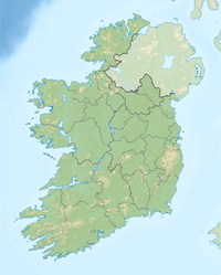
Hungry Hill (Template:Lang-ga) is a mountain on the Beara Peninsula in the Republic of Ireland. With a height of 685 metres (2,247 ft) it is the highest peak of the Caha Mountains and the 130th highest in Ireland.[1] Hungry Hill lies on the border of counties Cork and Kerry, although the peak is on the Cork side.
There is a cairn at the summit and a number of standing stones to the south and east of the mountain. At its eastern foot are two lakes — Coomadayallig and Coomarkane — which both drain into the Mare's Tail waterfalls. This is the highest waterfall in Ireland and the UK.[citation needed]
The first part of the Irish name Cnoc Daod means "hill". The second part may be a dialectal variant of déad, meaning "tooth", "set of teeth" or "jaw".[2] It has been anglicized as Knockdhead and Knockday.[3]
See also
References
- ^ a b "Hungry Hill". MountainViews.ie. Retrieved May 20, 2007.
- ^ Tempan, Paul. Irish Hill and Mountain Names. MountainViews.ie.
- ^ Placenames Database of Ireland (see archival records)


