Tuco (mountain)
| Tuku | |
|---|---|
| Wanaku Punta | |
| Highest point | |
| Elevation | 5,479 m (17,976 ft)[1] |
| Geography | |
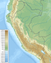
| Location | Peru, Ancash Region |
| Region | PE |
| Parent range | Cordillera Blanca |
| Climbing | |
| First ascent | 1-1963 via N.W. slopes[1] |
Tuku (Quechua for owl,[2] hispanicized spellings Tuco, Tucu) or Wanaku Punta (Quechua wanaku guanaco, punta peak, ridge; first, before, in front of, hispanicized Huanaco Punta)[2][3][4][5] is a mountain in the Andes in South America. Its summit is 5,479 m (17,976 ft)) high and it is one of the southernmost peaks in the snow-capped Cordillera Blanca in northwestern central Peru. Tuku is located in the Ancash Region, Bolognesi Province, Aquia District and in the Recuay Province, Catac District.[6][7] It is situated northeast of Qiwllarahu, between Challwa in the west and Pastu Ruri in the east.
Other neighboring peaks are K'uchurahu ("edge mountain with snow", Juchuraju) (5,392 m (17,690 ft)) and Santun (5,100 m (16,700 ft)). Rahu Kutaq (Rahut'una) (5,355 m (17,569 ft)) is the only peak further south in the Cordillera Blanca.
The glacial lakes on the southern flank of Tuku are the source of the Tuku River which flows to the south along the villages of Tuku (Tuco) and Tuku Mach'ay ("owl cave", Tuco Macray) to a lake named Awashqucha (Ahuashcocha) and then southwest to Quñuqqucha. With a length of 30 km (19 mi) Tuku River is the main tributary of Quñuqqucha. From there the Santa River flows along the Cordillera Blanca into the Pacific Ocean.
Sources
- ^ a b Taken from Mountaineering in the Andes by Jill Neate Peru RGS-IBG Expedition Advisory Centre, 2nd edition, May 1994
- ^ a b Teofilo Laime Ajacopa (2007). Diccionario Bilingüe: Iskay simipi yuyayk’anch: Quechua – Castellano / Castellano – Quechua (PDF). La Paz, Bolivia: futatraw.ourproject.org.
- ^ David Weber, A Grammar of Huallaga (Huánuco) Quechua, University of California Press, p. 185
- ^ homepage.ntlworld.com/robert_beer Robert Beér, Armando Muyolemaj, Dr. Hernán S. Aguilarpaj, Vocabulario comparativo, quechua ecuatoriano - quechua ancashino - castellano - English, Brighton 2006: Spanish Casa, Kichwa Wasi, Ancash Quechua Wayi, English House
- ^ John Biggar, The Andes: A Guide for Climbers, see sketch map on p. 90
- ^ escale.minedu.gob.pe - UGEL map of the Bolognesi Province (Ancash Region)
- ^ batguano.com Map of the Cordillera Blanca

