Farmer, Ohio
Appearance
Farmer, Ohio | |
|---|---|
 Farmer | |
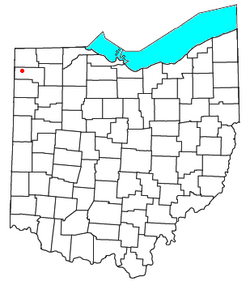
 Location of Farmer | |
| Country | United States |
| State | Ohio |
| County | Defiance |
| Elevation | 748 ft (228 m) |
| Time zone | UTC-5 (Eastern (EST)) |
| • Summer (DST) | UTC-4 (EDT) |
| ZIP code | 43520 |
| Area code | 419 |
| GNIS feature ID | 1064639[1] |
Farmer is an unincorporated community in central Farmer Township, Defiance County, Ohio, United States. Although it is unincorporated, it has a post office, with the ZIP code of 43520.[2] It is located at the intersection of State Routes 2 and 249.
History
Farmer was named for Nathaniel Farmer, an early settler.[3]
Notable
- Abe L. Biglow, businessman, educator, and member of the Wisconsin State Assembly, was born in Farmer.[4]
References
- ^ a b "US Board on Geographic Names". United States Geological Survey. 2007-10-25. Retrieved 2008-01-31.
- ^ Zip Code Lookup
- ^ Peacefull, Leonard (1996). A Geography of Ohio. Kent State University Press. p. 217. Retrieved 8 December 2013.
- ^ 'Wisconsin Blue Book 1921,' Biographical Sketch of Abe L. Biglow, pg. 260

