Perlez
Appearance
Perlez
Перлез | |
|---|---|
Village | |
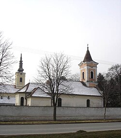
 Churches in Perlez: Orthodox and Catholic | |
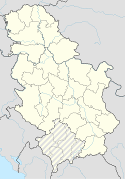
| Coordinates: 45°12′17″N 20°22′32″E / 45.20472°N 20.37556°E | |
| Country | Serbia |
| Province | Vojvodina |
| District | Central Banat |
| Elevation | 63 m (207 ft) |
| Population (2002) | |
• Perlez | 3,818 |
| Time zone | UTC+1 (CET) |
| • Summer (DST) | UTC+2 (CEST) |
| Postal code | 23260 |
| Area code | +381(0)23 |
| Car plates | ZR |
Perlez (Serbian Cyrillic: Перлез) is a village located in the Zrenjanin municipality, in the Central Banat District of Serbia. It is situated in the Autonomous Province of Vojvodina. The village has a Serb ethnic majority (87.29%) and its population numbering 3,818 people (2002 census).
History

Baden culture graves and ceramics (bowls, anthropomorphic urns) were found in the village.[1]
Population
This village had a small community of Croats, that lived in compact part of the village; they have been slowly but evidently in large amounts assimilated. Still, this assimilation has never drawn the attention of Croat parties in Serbia.[2]
- 1961: 4,881
- 1971: 4,458
- 1981: 4,283
- 1991: 3,880
See also
References
- Slobodan Ćurčić, Broj stanovnika Vojvodine, Novi Sad, 1996.
- ^ http://www.rastko.rs/arheologija/srejovic/dsrejovic-eneolit.html
- ^ Template:Sr icon Danas Sporovi nikome nisu potrebni, Mar 21, 2006 Archived July 13, 2009, at the Wayback Machine
External links
Wikimedia Commons has media related to Perlez.

