Șeica Mare
This article needs to be updated. (July 2010) |
Șeica Mare | |
|---|---|
 | |
 Location of Șeica Mare | |
| Coordinates: 46°1′N 24°9′E / 46.017°N 24.150°E | |
| Country | |
| County | Sibiu County |
| Population (2011)[1] | 4,234 |
| Time zone | UTC+2 (EET) |
| • Summer (DST) | UTC+3 (EEST) |
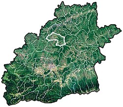
Șeica Mare (Template:Lang-de; Template:Lang-hu) is a commune located in Sibiu County, Romania. It is composed of six villages: Boarta, Buia, Mighindoala, Petiș, Șeica Mare and Ștenea. Calvaser (Kaltwasser; Hidegvíz) was also a village until the late 20th century, when it was absorbed by Șeica Mare village.
At the 2011 census, 88.8% of inhabitants were Romanians, 6% Hungarians, 4.2% Roma and 1% Germans.
Villages
| In Romanian | In German | In Hungarian |
|---|---|---|
| Boarta | Michelsdorf | Mihályfalva |
| Buia | Bell | Bólya |
| Mighindoala | Engenthal | Ingodály |
| Petiș | Petersdorf | Kispéterfalva |
| Șeica Mare | Marktschelken | Nagyselyk |
| Ștenea | Stein | Isztina |
Buia village was first attested in a document of 1269, under the name of poss Bulla. In 1918, it had 1167 residents, of whom 736 were Romanians and the rest Germans and Hungarians. By 2002, the population was down to 634: 516 Romanians, 104 Hungarians and three Roma. The village is in the southern part of the commune, linked to Șeica Mare by an 11 km stretch of county road.[2] Farkas Bolyai was born there in 1775.[3]
Mighindoala (Template:Lang-de, meaning "Angels' Valley",[4] Template:Lang-hu) is a small village in the Șeica Mare commune.
This place is located at 46.0000 North latitude and 24.2833 East longitude. The altitude is 557 metres (1,827 ft) above the sea level.
As recently as 1975, the village had in excess of 50 houses, but was gradually deserted after the communist regime withdrew infrastructure such as teachers and doctors.[5][6] [citation needed] As of 2004, there were only four people left in this village.[citation needed] There were only about ten buildings standing, including the Protestant church.[citation needed] The Romanian Orthodox church no longer has a roof, and trees are growing inside it.[7]
The only economic activity there is agriculture, very much based on the traditional farming of sheep, cows and horses.[citation needed]
Gallery
-
Ruins of Buia Castle
-
The road on Mighindoala river valley
-
German Church in Mighindoala
-
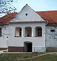
House in the village
-
The fortified church of Șeica Mare
-
The fortified church of Șeica Mare
-
The fortified church of Șeica Mare
-
The fortified church of Șeica Mare
References
- ^ Romanian census data, 2011; retrieved on March 17, 2012
- ^ Template:Ro icon Sate aparţinătoare at the Șeica Mare Town Hall site; accessed July 14, 2013
- ^ Barna Szénássy, János Bolyai Appendix, p.220. Elsevier, 1987, ISBN 0-080-87249-2
- ^ http://www.istru.org/
- ^ see this article
- ^ Article in romanian language here
- ^ see this photo taken from inside the Orthodox Church


