Tiefencastel railway station
Appearance
Tiefencastel | |||||
|---|---|---|---|---|---|
 Platforms at Tiefencastel station | |||||
| General information | |||||
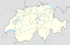
| Location | Julierstrasse 7450 Tiefencastel Albula, Graubünden Switzerland | ||||
| Coordinates | 46°39′50″N 9°34′22″E / 46.66389°N 9.57278°E | ||||
| Elevation | 884 m | ||||
| Owned by | Rhaetian Railway | ||||
| Operated by | Rhaetian Railway | ||||
| Line(s) | Albula Railway | ||||
| Distance | 53.95 km from Thusis | ||||
| History | |||||
| Opened | 1 July 1903 | ||||
| Electrified | 15 October 1919 | ||||
| |||||
| |||||
Tiefencastel is a railway station in Tiefencastel, Switzerland. It is located on the Albula Railway line from Chur to St. Moritz. Hourly services operate on this section of the line.
Rhaetian Railway services
- RE1/R11 - 1tph
| Preceding station | Rhatische Bahn | Following station | ||
|---|---|---|---|---|
toward Template:RhB stations | Template:RhB lines | toward Template:RhB stations |
||
| Template:RhB lines |
Accidents and incidents
On 13 August 2014, a passenger train was struck by a landslide and derailed at Tiefencastel. Eleven people were injured.
References
External links


