Canchungo
Appearance
Canchungo | |
|---|---|
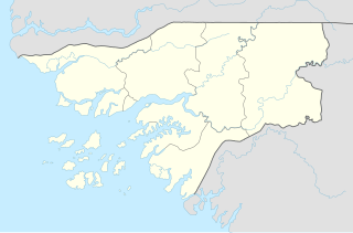
| Coordinates: 12°4′2″N 16°2′0″W / 12.06722°N 16.03333°W | |
| Country | |
| Region | Cacheu Region |
| Population (2008 est.) | |
• Total | 6,434 |
Canchungo is a town located in the western Cacheu Region of Guinea-Bissau formerly known as Vila Teixeira Pinto after Major Teixeira Pinto, the colonial officer that pacified the area.
Population 6,434 (2008 est).[1] The metropolitan area has about 10.000 inhabitants mainly from Papels and Balantas. The population are predominantly Christians (especially Roman Catholics and some Protestants). Jehova's Witnesses are also active there. A small minority are Muslims.
References
- ^ World Gazetteer Archived October 5, 2008, at the Wayback Machine, Retrieved on June 16, 2008


