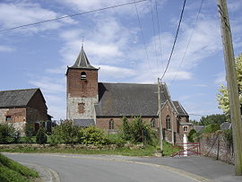
Beaudignies
Appearance
Beaudignies | |
|---|---|
 | |
| Coordinates: 50°14′15″N 3°35′37″E / 50.2375°N 3.5936°E | |
| Country | France |
| Region | Hauts-de-France |
| Department | Nord |
| Arrondissement | Avesnes-sur-Helpe |
| Canton | Avesnes-sur-Helpe |
| Intercommunality | Quercitain |
| Government | |
| • Mayor (2008–2014]) | Raymonde Dramez |
Area 1 | 7.92 km2 (3.06 sq mi) |
| Population (2009) | 573 |
| • Density | 72/km2 (190/sq mi) |
| Time zone | UTC+01:00 (CET) |
| • Summer (DST) | UTC+02:00 (CEST) |
| INSEE/Postal code | 59057 /59530 |
| Elevation | 65–131 m (213–430 ft) (avg. 99 m or 325 ft) |
| 1 French Land Register data, which excludes lakes, ponds, glaciers > 1 km2 (0.386 sq mi or 247 acres) and river estuaries. | |
Beaudignies is a commune in the Nord department in northern France.
Population
| Year | Pop. | ±% |
|---|---|---|
| 1793 | 586 | — |
| 1800 | 434 | −25.9% |
| 1806 | 479 | +10.4% |
| 1821 | 818 | +70.8% |
| 1831 | 921 | +12.6% |
| 1836 | 996 | +8.1% |
| 1841 | 1,073 | +7.7% |
| 1846 | 1,065 | −0.7% |
| 1851 | 1,151 | +8.1% |
| 1856 | 1,208 | +5.0% |
| 1861 | 1,235 | +2.2% |
| 1866 | 1,177 | −4.7% |
| 1872 | 1,213 | +3.1% |
| 1876 | 1,172 | −3.4% |
| 1881 | 1,215 | +3.7% |
| 1886 | 1,211 | −0.3% |
| 1891 | 1,241 | +2.5% |
| 1896 | 1,208 | −2.7% |
| 1901 | 1,150 | −4.8% |
| 1906 | 1,133 | −1.5% |
| 1911 | 1,029 | −9.2% |
| 1921 | 852 | −17.2% |
| 1926 | 805 | −5.5% |
| 1931 | 785 | −2.5% |
| 1936 | 702 | −10.6% |
| 1946 | 696 | −0.9% |
| 1954 | 667 | −4.2% |
| 1962 | 603 | −9.6% |
| 1968 | 597 | −1.0% |
| 1975 | 527 | −11.7% |
| 1982 | 543 | +3.0% |
| 1990 | 523 | −3.7% |
| 1999 | 537 | +2.7% |
| 2006 | 573 | +6.7% |
| 2009 | 573 | +0.0% |
Heraldry
 |
The arms of Beaudignies are blazoned : Gules, a crescent between 8 billets in orle, all argent.
|
See also
References
Wikimedia Commons has media related to Beaudignies.


