Elburg
Elburg | |
|---|---|
 View of Elburg from the church tower | |
 Location in Gelderland | |
| Coordinates: 52°27′N 5°51′E / 52.450°N 5.850°E | |
| Country | Netherlands |
| Province | Gelderland |
| Government | |
| • Body | Municipal council |
| • Mayor | Harry Dijksma (VVD) |
| Area | |
• Total | 65.91 km2 (25.45 sq mi) |
| • Land | 63.82 km2 (24.64 sq mi) |
| • Water | 2.09 km2 (0.81 sq mi) |
| Elevation | 1 m (3 ft) |
| Population (January 2021)[4] | |
• Total | 23,429 |
| • Density | 367/km2 (950/sq mi) |
| Demonym | Elburger |
| Time zone | UTC+1 (CET) |
| • Summer (DST) | UTC+2 (CEST) |
| Postcode | 8080–8085 |
| Area code | 0525 |
| Website | www |
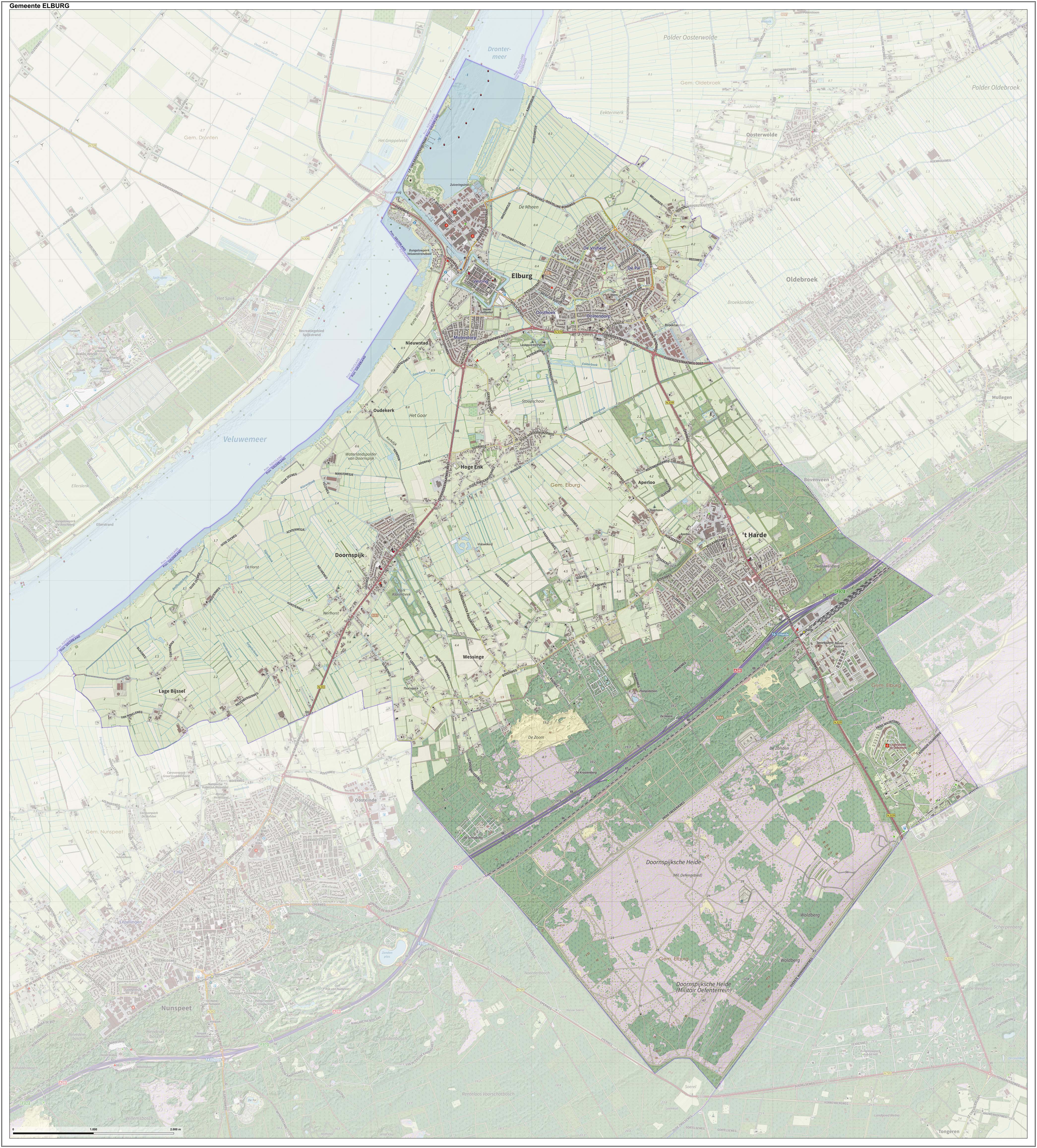
 Elburg () is a municipality and a city in the province of Gelderland, Netherlands.
History
There is evidence of a Neolithic settlement at Elburg consisting of stone tools and pottery shards.
From Roman times there are names and shards of earthenware which suggest that there was an army camp at the site of Elburg.
The earliest extant written record of Elburg is from 796 AD.
Between 1392 and 1396 Elburg was rebuilt after a flood in the form it is seen today, with a moat and a city wall, together with a gridiron street plan. This rapid rebuilding was expensive, indicating that Elburg was reasonably affluent in medieval times.
Several records of Elburg date back to the 14th century. Elburg was granted town status by Earl Jan van Geel early in the century. There is a record that Elburg got its fishing right granted in 1313. In 1367 the city was recorded as a member of the Hanseatic League.
Throughout the centuries, Elburgh remained a fishing and farming center until the end of World War II. Unlike many other Dutch towns, Elburg had refused to use city funds to build a railroad station in 1863. Because the land owners were asking unreasonably high prices for the right of way over their property, the track line Utrecht-Amersfoort-Zwolle bypassed Elburg. As a consequence, Elburg became less attractive for manufacturers compared with neighboring places like Harderwijk. In addition, the closing off of the Zuiderzee in 1932 meant an end to the fishing industry of Elburg, since the former salt water bay gradually became a fresh water body. Therefore, since 1956, the city concluded that only tourism would be the most viable sector for the local economy. Because of its favourable position both on the edge of the canal and near the Veluwemeer, tourists have made it a popular tourist destination. Each year many visit to see the largely unchanged medieval town, especially during the 'Midweekfeesten' (mid-week feasts), 'Botterdagen' (Botter days - a botter is a type of flat-bottomed fishing boat) and 'Kerst in de Vesting' (Christmas in the Fortress), which attract more than 30,000 visitors each year.
Population Centers
- Doornspijk
- Elburg
- 't Harde
- Hoge Enk
- Oostendorp
People born in Elburg
- Kira Bulten (born 1973), swimmer
- Pieter Jan Leusink (born 1958), musician
- Jacob Jan van der Maaten (1820–1879), painter
- Jan van der Elburcht (1500 – 1571), painter
Gallery
-
Church tower (de Sint Nicolaaskerk)
-
View of the port
-
Vischpoort (Fish Gate)
-
Synagogue in Elburg
References
- ^ "Burgemeester H. Dijksma" (in Dutch). Gemeente Elburg. Retrieved 1 February 2017.
{{cite web}}: Unknown parameter|trans_title=ignored (|trans-title=suggested) (help) - ^ "Kerncijfers wijken en buurten 2020" [Key figures for neighbourhoods 2020]. StatLine (in Dutch). CBS. 24 July 2020. Retrieved 19 September 2020.
- ^ "Postcodetool for 8081LA". Actueel Hoogtebestand Nederland (in Dutch). Het Waterschapshuis. Retrieved 30 June 2014.
{{cite web}}: Cite has empty unknown parameter:|trans_title=(help) - ^ "Bevolkingsontwikkeling; regio per maand" [Population growth; regions per month]. CBS Statline (in Dutch). CBS. 1 January 2021. Retrieved 2 January 2022.
External links
 Media related to Elburg at Wikimedia Commons
- Official website


