[ 1] Name on the Register
Image
Date listed[ 2]
Location
City or town
Description
1
Bishop House Bishop House March 12, 2001 (#01000270 ) 818 East Second Street 42°29′18″N 106°18′26″W / 42.488333°N 106.307222°W / 42.488333; -106.307222 (Bishop House ) Casper
4
Bridger Immigrant Road-Waltman Crossing Upload image January 17, 1975 (#75001905 ) 49 miles west of Casper on U.S. Route 20 43°04′20″N 107°12′41″W / 43.072222°N 107.211389°W / 43.072222; -107.211389 (Bridger Immigrant Road-Waltman Crossing ) Casper
5
Casper Army Air Base Casper Army Air Base August 3, 2001 (#01000789 ) 8500 Fuller St. 42°53′31″N 106°50′34″W / 42.891944°N 106.842778°W / 42.891944; -106.842778 (Casper Army Air Base ) Casper
7
Casper Downtown Historic District Upload image October 17, 2016 (#16000732 ) Generally bounded by Midwest Ave., W. B, W. C, & Beech Sts. 42°50′55″N 106°19′31″W / 42.848722°N 106.325186°W / 42.848722; -106.325186 (Casper Downtown Historic District ) Casper
8
Casper Federal Building Casper Federal Building December 21, 1998 (#98001536 ) 111 S. Wolcott St. 42°50′59″N 106°19′22″W / 42.849722°N 106.322778°W / 42.849722; -106.322778 (Casper Federal Building ) Casper Now known as the Ewing T. Kerr Federal Building and U.S. Courthouse.
9
Casper Fire Department Station No. 1 Casper Fire Department Station No. 1 November 4, 1993 (#93001187 ) 302 S. David St. 42°50′52″N 106°19′35″W / 42.847778°N 106.326389°W / 42.847778; -106.326389 (Casper Fire Department Station No. 1 ) Casper
10
Casper Motor Company-Natrona Motor Company Upload image February 23, 1994 (#94000042 ) 230 W. Yellowstone Highway 42°50′55″N 106°19′36″W / 42.848611°N 106.326667°W / 42.848611; -106.326667 (Casper Motor Company-Natrona Motor Company ) Casper
11
Chicago and Northwestern Railroad Depot Upload image January 7, 1988 (#87002296 ) 35231 W. Dakota Ave. 43°02′04″N 106°59′10″W / 43.034444°N 106.986111°W / 43.034444; -106.986111 (Chicago and Northwestern Railroad Depot ) Powder River
12
Church of Saint Anthony Church of Saint Anthony January 30, 1997 (#96001631 ) 604 S. Center St. 42°50′37″N 106°19′29″W / 42.843611°N 106.324722°W / 42.843611; -106.324722 (Church of Saint Anthony ) Casper
13
Consolidated Royalty Building Consolidated Royalty Building November 4, 1993 (#93001186 ) 137-141 S. Center St. 42°50′57″N 106°19′27″W / 42.849167°N 106.324167°W / 42.849167; -106.324167 (Consolidated Royalty Building ) Casper
15
Elks Lodge No. 1353 Elks Lodge No. 1353 January 30, 1997 (#96001632 ) 108 E. 7th St. 42°50′38″N 106°19′27″W / 42.843889°N 106.324167°W / 42.843889; -106.324167 (Elks Lodge No. 1353 ) Casper
16
Fort Caspar Fort Caspar August 12, 1971 (76002282 #71000887; 76002282 ) 14 Fort Caspar Rd.; also an area on the northern side of the fort along the Platte River 42°50′09″N 106°22′19″W / 42.835833°N 106.371944°W / 42.835833; -106.371944 (Fort Caspar ) Casper Second set of boundaries represents a boundary increase
17
Grant Street Grocery and Market Upload image October 15, 2008 (#08001005 ) 815 S. Grant St. 42°51′30″N 107°19′02″W / 42.858333°N 107.317222°W / 42.858333; -107.317222 (Grant Street Grocery and Market ) Casper
18
Independence Rock Independence Rock October 15, 1966 (#66000757 ) 60 miles southwest of Casper on Wyoming Highway 220 42°29′38″N 107°07′48″W / 42.493889°N 107.13°W / 42.493889; -107.13 (Independence Rock ) Casper
19
Martin's Cove Martin's Cove March 8, 1977 (#77001383 ) West of Casper 42°27′16″N 107°14′43″W / 42.454444°N 107.245278°W / 42.454444; -107.245278 (Martin's Cove ) Casper
20
Masonic Temple Masonic Temple August 24, 2005 (#05000926 ) 105 N. Center St. 42°51′01″N 106°19′27″W / 42.850278°N 106.324167°W / 42.850278; -106.324167 (Masonic Temple ) Casper
21
Midwest Oil Company Hotel Upload image November 17, 1983 (#83004302 ) 136 E. 6th St. 42°50′41″N 106°19′25″W / 42.844722°N 106.323611°W / 42.844722; -106.323611 (Midwest Oil Company Hotel ) Casper
22
Dean Morgan Junior High School Upload image May 3, 2016 (#16000229 ) 1440 South Elm Street 42°50′09″N 106°19′46″W / 42.835852°N 106.329570°W / 42.835852; -106.329570 (Dean Morgan Junior High School ) Casper
23
Natrona County High School Natrona County High School January 7, 1994 (#93001491 ) 930 South Elm Street 42°50′36″N 106°19′43″W / 42.843333°N 106.328611°W / 42.843333; -106.328611 (Natrona County High School ) Casper
24
North Casper Clubhouse Upload image February 18, 1994 (#94000043 ) 1002 East L Street 42°51′43″N 106°18′42″W / 42.861944°N 106.311667°W / 42.861944; -106.311667 (North Casper Clubhouse ) Casper
25
Odd Fellows Building Odd Fellows Building June 18, 2009 (#09000455 ) 136 South Wolcott Street 42°50′58″N 106°19′26″W / 42.849578°N 106.323806°W / 42.849578; -106.323806 (Odd Fellows Building ) Casper
26
Ohio Oil Company Building Ohio Oil Company Building July 25, 2001 (#01000791 ) 159 North Wolcott Street 42°51′04″N 106°19′22″W / 42.851111°N 106.322778°W / 42.851111; -106.322778 (Ohio Oil Company Building ) Casper
27
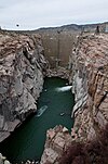
Pathfinder Dam Pathfinder Dam August 12, 1971 (#71000888 ) 45 miles southwest of Casper 42°28′05″N 106°51′12″W / 42.468056°N 106.853333°W / 42.468056; -106.853333 (Pathfinder Dam ) Casper Includes just the dam.
29
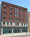
Rialto Theater Rialto Theater February 11, 1993 (#93000037 ) 102 East Second Street 42°50′55″N 106°19′09″W / 42.848611°N 106.319167°W / 42.848611; -106.319167 (Rialto Theater ) Casper
30
Roosevelt School Roosevelt School January 30, 1997 (#96001633 ) 140 E. K St. 42°51′59″N 106°19′25″W / 42.866389°N 106.323611°W / 42.866389; -106.323611 (Roosevelt School ) Casper
31
South Wolcott Street Historic District Upload image November 23, 1988 (#88002609 ) Roughly bounded by S. Center St., E. 9th St., S. Wolcott St., E. 7th St., S. Beech St., and E. 13th St. 42°50′25″N 106°19′21″W / 42.840278°N 106.3225°W / 42.840278; -106.3225 (South Wolcott Street Historic District ) Casper
33
Stone Ranch Stage Station Stone Ranch Stage Station November 1, 1982 (#82001834 ) Northwest of Casper on U.S. Routes 20 /26 42°57′44″N 106°38′56″W / 42.962222°N 106.648889°W / 42.962222; -106.648889 (Stone Ranch Stage Station ) Casper
34
Tom Sun Ranch Tom Sun Ranch October 15, 1966 (#66000753 ) 6 miles west of Independence Rock on Wyoming Highway 220 42°26′40″N 107°14′36″W / 42.444444°N 107.243333°W / 42.444444; -107.243333 (Tom Sun Ranch ) Independence Rock
35
Teapot Rock Teapot Rock December 30, 1974 (#74002028 ) Off U.S. Route 87 43°14′00″N 106°18′37″W / 43.233333°N 106.310278°W / 43.233333; -106.310278 (Teapot Rock ) Midwest
36
Townsend Hotel Townsend Hotel November 25, 1983 (#83004303 ) 115 North Center Street 42°50′56″N 106°19′27″W / 42.848889°N 106.324167°W / 42.848889; -106.324167 (Townsend Hotel ) Casper
37
Tribune Building Upload image February 18, 1994 (#94000041 ) 216 East Second Street 42°50′56″N 106°19′22″W / 42.848889°N 106.322778°W / 42.848889; -106.322778 (Tribune Building ) Casper
38
Turner-Cottman Building Upload image December 1, 2015 (#15000856 ) 120-130 West Secondnd Street 42°50′55″N 106°19′33″W / 42.848684°N 106.325913°W / 42.848684; -106.325913 (Turner-Cottman Building ) Casper
}}


