Punta Nati Lighthouse
Appearance
 Punta Nati Lighthouse | |
 | |
| Location | Punta Nati Menorca Spain |
|---|---|
| Coordinates | 40°03′01″N 3°49′25″E / 40.050229°N 3.823542°E |
| Tower | |
| Constructed | 1911 |
| Construction | stone tower |
| Height | 19 metres (62 ft) |
| Shape | octagonal prism tower with balcony and lantern |
| Markings | unpainted stone tower, grey lantern |
| Power source | mains electricity |
| Operator | Comisión de faros[1] |
| Light | |
| Focal height | 42 metres (138 ft) |
| Light source | mains power |
| Range | 18 nautical miles (33 km; 21 mi) |
| Characteristic | Fl (4) W 20s. |
| Spain no. | ES-36680 |
The Punta Nati Lighthouse is an active lighthouse on the Spanish island of Menorca.[2][3][4][5]
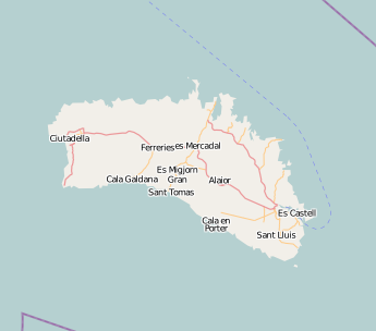
Map showing the lighthouses of Menorca
See also
References
- ^ Punta Nati The Lighthouse Directory. University of North Carolina at Chapel Hill. Retrieved March 26, 2016
- ^ "Punta Nati Lighthouse". Balearic Lighthouses. Port Authority of Balearic Islands. Retrieved 20 September 2014.
- ^ Rowlett, Russ. "Lighthouses of Spain: Balearic Islands". The Lighthouse Directory. University of North Carolina at Chapel Hill.
- ^ "Menorcas Shining Lights". Museums & Lighthouses. Menorca-live.com. Retrieved 20 September 2014.
- ^ "The Lighthouses of Menorca". Discovering Menorca. descobreixmenorca.com. Retrieved 20 September 2014.
External links
Wikimedia Commons has media related to Far de Punta Nati.

