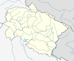
Pithoragarh
Pithoragarh | |
|---|---|
Town | |
 Himalyan view from Pithoragarh | |
| Coordinates: 29°35′N 80°13′E / 29.58°N 80.22°E | |
| Country | |
| State | Uttarakhand |
| District | Pithoragarh |
| Elevation | 1,514 m (4,967 ft) |
| Population (2011)[1] | |
• Total | 56,044 |
| Time zone | UTC+5:30 (IST) |
| PIN | 262501 |
| Telephone code | 915964 |
| Vehicle registration | UK |
| Website | pithoragarh |
Pithoragarh is a town with a Municipal Board in the Pithoragarh district in the Indian state of Uttarakhand, which was carved out of the Almora district in 1960.
Geography
Pithoragarh is located at 29°35′N 80°13′E / 29.58°N 80.22°E.[2] It has an average elevation of 1,514 metres (4,967 feet).[3][4]
History
"The district is named after its headquarters town, Pithoragarh. Tradition has it that during the reign of the Chand Rajas of Kumaon, one Piru, also called Prithvi Gosain, built a fort here and named it Prithvigarh which, in the course of time, got changed into Pithoragarh."[3]
Places of interest

Sharadotsav
Pithorgarh is known for its unique culture. Saradotsav has played a significant role in conserving and sharing this culture. It is an important event that draws a huge crowds and showcases local culture through music and dance, often featuring performances in the Kumaoni language. Schools from the different part of district performed folk dances and songs. Various competitions are also held.
In popular culture
The small town has been extensively described in a novel by American author Bradley Swift titled, From Pithoragarh to Pittsburg.
How to reach Pithoragarh
Pithoragarh is connected to the outside world by road although it has a seldom-used air strip. Haldwani and Tanakpur are two entry points for entering Pithoragarh from plains. Both these places are connected by railway services. Regular state bus transport services along with private taxi services are available at both places.
Education

Schools in Pithoragarh are run by the state government or private organisations, many of which are religious. Hindi and English are the primary languages of instruction. Schools in Pithoragarh follow the "10+2+3" plan. After completing their secondary education, students typically enroll in Inter Colleges that have a higher secondary facility and are affiliated with the ICSE, the CBSE or the Department of Education of the Government of Uttarakhand. They usually choose a focus on liberal arts, business, or science.
As of 2011, Pithoragarh has a total of 17 Primary Shools, 20 middle schools, 22 secondary schools, 14 senior secondary schools and 1 degree college.[5]: 685 Before independence, during the middle of nineteenth century when Pithoragarh was part of Almora, there were only two middle schools in Pithoragarh.[6] LSM Govt. Post Graduate College is the only government in the town college providing studies upto post-Graduation.[7] It is affiliated to Kumaun University, Nainital. With the growing impact of I.T, government opened SIT pithoragarh in 2011. Almost a dozen of privately owned Computer Centre opened up later in the town.[6] A few of IT centres which are located in the Pithoragarh town are NIIT, Hiltron, Aptech, Manipal University, UpHill Computers, Info.Park, Sri Calculation and Care Computer.
References
- ^ "Census of India Search details". censusindia.gov.in. Retrieved 10 May 2015.
- ^ Falling Rain Genomics, Inc – Pithoragarh
- ^ a b A document from official website of Pithoragarh
- ^ Official website of Pithoragarh
- ^ District Census Handbook Pithoragarh Part-A (PDF). Dehradun: Directorate of Census Operations, Uttarakhand. Retrieved 11 July 2017.
- ^ a b Indusnettechnologies, Goutam Pal, Dipak K S, SWD. "Education: District of Pithoragarh, Uttarakhand, India". pithoragarh.nic.in. Retrieved 11 July 2017.
{{cite web}}: CS1 maint: multiple names: authors list (link) - ^ Indusnettechnologies, Goutam Pal, Dipak K S, SWD. "L. S. M. Government Post Graduate College Pithoragarh (Uttarakhand)". pithoragarh.nic.in. Retrieved 11 July 2017.
{{cite web}}: CS1 maint: multiple names: authors list (link)


