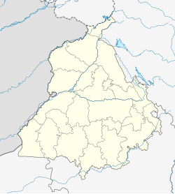
Gumtala
Appearance
Gumtala | |
|---|---|
Village | |
| Coordinates: 31°39′52″N 74°51′14″E / 31.66444°N 74.85389°E | |
| Country | |
| State | Punjab |
| District | Jalandhar |
| Languages | |
| • Official | Punjabi |
| Time zone | UTC+5:30 (IST) |
| PIN | 143001 [1] |
| Telephone code | 0183 |
| Vehicle registration | PB- 02 |
Gumtala is a village in close to Jalandhar of Indian state of Punjab. It is very close to the small town of Nurmahal.
About
Gumtala lies on the Phillaur-Nurmahal Road. The nearest main road to Gumtala is Phillaur-Nurmahal road which is almost 2 kilometres from the village. The nearest railway station to Gumtala is Gumtali Railway station. Gumtala is known in the region as the village with large homes or "khotis". The village residents mainly have the surname Pahal and are known as wealthy land owners.[citation needed]
References


