Jump to content

Nema Kunku

Coordinates: 13°24′N 16°41′W / 13.400°N 16.683°W / 13.400; -16.683
From Wikipedia, the free encyclopedia

This is an old revision of this page, as edited by Brookie (talk | contribs) at 15:48, 22 November 2017 (Copyedit (minor)). The present address (URL) is a permanent link to this revision, which may differ significantly from the current revision.

Nema Kunku
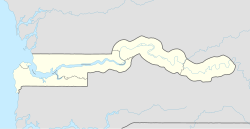
Nema Kunku is located in The Gambia
Nema Kunku
Nema Kunku
Location in the Gambia
Coordinates: 13°24′25″N 16°25′48″W / 13.40694°N 16.43000°W / 13.40694; -16.43000
CountryThe Gambia
DivisionWestern Division
DistrictFoni Jarrol
Elevation
29 m (95 ft)
Population
 (2013)
 • Total
36,134

Nema Kunku is a village in Foni Jarrol district in the Western Division of the Gambia,

it is near Gambia's largest town Serekunda. The population of the village is 99% local (Gambian) people.

13°24′N 16°41′W / 13.400°N 16.683°W / 13.400; -16.683