Kotorr, Kosovo
Kotorr | |
|---|---|
Village | |
| Kotorr/Kotore | |
 | |
| Coordinates: 42°48′04″N 20°44′35″E / 42.80111°N 20.74306°E | |
| Country | Kosovo |
| District | District of Mitrovica |
| Municipality | Skenderaj |
| Population (2011) | |
• Total | 279 |
| Time zone | UTC+1 (CET) |
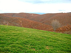
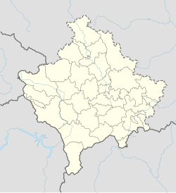
Kotorr (in Albanian) or Kotore (in Serbian; Которе) is a village in Kosovo located in the town-municipality of Skenderaj/Srbica and in the District of Mitrovica. According to the 2011 census, it had 279 inhabitants, all of whom were Albanian.

Geography
The village is located on the north side of the Pec-Mitrovica road, some 8 kilometres north-west of Skenderaj/Srbica.[1]
History
The village was mentioned in the 1455 Ottoman defter (tax registry) of the conquered lands of Vuk Branković.[1] It had 33 Serbian households served by priest Vladislav.[1] The village had an old church, of which only micro-toponyms exist today: "Church" (sr. Crkva, sq. Kisha), and "Church Valley" (sr. Crkveni do, sq. Lugu i Kishës).[1][2]
After the Kosovo War, during the presence of the NATO-led peacekeeping Kosovo Force, two houses belonging to Serbs were burnt down and one house was illegally occupied.[3]
Demographics
| Year | 1948 | 1953 | 1961 | 1971 | 1981 | 1991 | 2011 |
|---|---|---|---|---|---|---|---|
| Population | 401 | 422 | 422 | 430 | 494 | 516 | 279 |
| Template:Line chart |
References
- ^ a b c d Алексей Лидов (2007). Косово: Ортходокс херитаже анд контемпорары катастрофе. Индрик. p. 289.
- ^ Gojko Subotić (1997). Terra Sacra: L'Arte Del Cossovo. Jaca Book. ISBN 978-88-16-60198-7.
- ^ Zoran Andjelković; Center for Peace and Tolerance (2000). Days of terror: in the presence of the international forces. Center for peace and tolerance. pp. 105, 154.
Kotore, Srbica
- ^ "Evolution of the population 1948-2011". http://pop-stat.mashke.org/kosovo-census-ks.htm. Retrieved 14 September 2014.
{{cite web}}: External link in|website=

