Asanga, Nigeria
Appearance
Asanga | |
|---|---|
| Etymology: Idung Annang | |
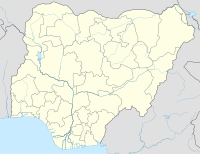
Location of Asanga in Nigeria | |
| Coordinates: 4°54′0″N 7°43′0″E / 4.90000°N 7.71667°E | |
| Country | |
| State | Akwa Ibom State |
| Elevation | 156 m (512 ft) |
| Time zone | [[UTC+1 +Lagos]] (WAT) |
Asanga also known as Nung Ikot Asanga is a town located in the Nung Ikot Clan, Oruk Anam local government area of Akwa Ibom State, the southern region of Nigeria.[1][2][3]
Villages
Asanga also called Asanga Nigeria is among the Annang ethnical group of Akwa Ibom State. The town is subdivided into five villages namely; Ataessien, Ikot Enuah, Ikot Akpanang, Ikot Oboho and Ikot Eweh.[4]
It shares some common boundaries with Ikot Okoro, Ntak Ibesit, Obiakpa. Others include; Ikot Afanga, Ikot Ntuen. Ukpom Edem Inyang.[5]
Nearby Cities
- Abak in the north
- Ukanafun in the west
- Mkpat Enin/Etinan in the east
- Rivers State in the southern part of the town
Churches
| Asanga popular religious groups | Centres |
|---|---|
| Christ Faith Church | Dist.17 Hqters, Asanga |
| Nazareth Baptist Church | Southeast Dist. Hqters. |
| Solid Rock Kingdom Church | Pillar Of Fire Tabernacle |
| Qua Iboe Church | Asanga Dist. Supt'cy |
| United Pentecostal | Asanga Area Hqters |
| Elect Family Ministry | Asanga Bethel Hqters |
| The Apostolic Church Nigeria | Nung Ik.Asanga |
| Methodist Church | Nung Ik.Asanga |
| Christ Evangelical Church | Nung Ik. Asanga |
References
- ^ "Details- Asanga". Getamap.
- ^ National Gazetteer of Place Names: Cross River State. National Population Bureau, Demographic Division. 1985.
- ^ Office, Nigeria Federal Census. Population Census of Nigeria, 1963: Northern Region: Eastern Region. 2 pts.
- ^ "Details - Asanga". Mapcarta Pub. Retrieved 2017-09-18.
- ^ "Asanga - Nearby". 1worldmap.com/Nigeria/Akwa-Ibom-State/Asanga/2349240. Retrieved 2017-09-18.

