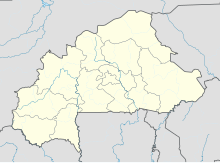
Thomas Sankara International Airport Ouagadougou
Ouagadougou Airport | |||||||||||||||
|---|---|---|---|---|---|---|---|---|---|---|---|---|---|---|---|
 | |||||||||||||||
| Summary | |||||||||||||||
| Airport type | Public / Military | ||||||||||||||
| Serves | Ouagadougou | ||||||||||||||
| Location | Ouagadougou, Burkina Faso | ||||||||||||||
| Hub for | Air Burkina | ||||||||||||||
| Elevation AMSL | 1,037 ft / 316 m | ||||||||||||||
| Coordinates | 12°21′11″N 01°30′44″W / 12.35306°N 1.51222°W | ||||||||||||||
| Map | |||||||||||||||
 | |||||||||||||||
| Runways | |||||||||||||||
| |||||||||||||||
| Statistics (2011) | |||||||||||||||
| |||||||||||||||
Ouagadougou Airport (IATA: OUA, ICAO: DFFD) is an airport in the center of the capital city of Ouagadougou in Burkina Faso. It was built in the 1960s, and it is approximately 1.5 km southeast of the main commercial area. The site itself is approximately 4.8 km in length, 0.5 km in width at its narrowest point, and covers an area of approximately 426 hectares. Its runway is 3 000 m long. When the airport was built it was on the southern boundary of the city. Ouagadougou has since experienced rapid urbanization and the airport is now surrounded by urban development.[2]
Besides having outgrown its capacity constraints, Ouagadougou Airport is a source of pollution and risk. The government has plans for a new airport 30 km north of the capital.[2][3]
In addition to civilian traffic, the airport has a military sector.[4]
'Ouagadougou Airport handles about 98% of all scheduled commercial air traffic in Burkina Faso. Air Burkina and Air France handle about 60% of scheduled passenger traffic. Between 2005 and 2011, air passenger traffic at Ouagadougou airport grew at an average annual rate of 7.0%, reaching about 404,726 passengers in 2011 and was estimated to reach 850,000 by 2025.
In 2007 it was the 15th busiest airport in West Africa in passenger volume, just ahead of Port Harcourt (Nigeria) and behind Banjul (Gambia).
The total air cargo grew 71% from 4,350 tons in 2005 to about 7,448 tons in 2009.[5]
Airlines and destinations
Passenger
Cargo
| Airlines | Destinations |
|---|---|
| Air France Cargo | Paris–Charles de Gaulle |
| Cargolux | Luxembourg |
| Emirates SkyCargo | Dakar, Dubai–Al Maktoum, Frankfurt |
Military use
The United States military uses the military side of the airport as the hub of its airborne intelligence operations for much of Western Africa.
The surveillance operations are carried out mainly with small, unarmed turboprop aircraft disguised as private planes but full of surveillance equipment. The U.S. spy planes fly hundreds of miles north to Mali, Mauritania and the Sahara, where they search for Al-Qaida fighters from the Maghreb. The planes refuel on isolated airstrips favored by African bush pilots, extending their effective flight range by thousands of miles.
Ouagadougou is the most important of the approximately dozen air bases that the U.S. established in Africa since 2007.[4]
Plans for a new airport
The government plans to close the current airport upon construction of the Ouagadougou-Donsin Airport, approximately 35 km northeast of Ouagadougou near the village of Donsin. It is expected to be completed around 2018, and the government of Burkina Faso has a $85 million loan from the World Bank to help finance the construction.[3][5] The government of Burkina Faso believed that the project would cost $618 million.[2]
The first phase of construction of the new airport was planned for a five-year period beginning in 2013 and finishing in 2018. This phase will focus on the construction of infrastructure that is required to move the operations from Ouagadougou to Donsin. The plans call for a single runway 3 500 m long, which is 500 m longer than the one at the current airport, with an option to extend to 4 000 m. Generally 3 000 m is sufficient to land virtually any aircraft at sea level, but longer runways are helpful for heavily loaded cargo planes. Space for a second runway and its accompanying infrastructure has been reserved for when growth in air traffic warrants it.[2]
A second expansion phase is planned for 2026–2030 to meet projected increases in demand. At this stage, however, the government of Burkina Faso is seeking investors only for Phase 1.
Accidents and incidents
- On 24 July 2014, Air Algérie Flight 5017 en route from Ouagadougou Airport to Houari Boumediene Airport, Algiers, Algeria, crashed about 50 minutes after take-off. The McDonnell Douglas MD-83 was carrying 110 passengers and 6 crew from 15 nationalities. The aircraft crashed southeast of Gossi, Mali. There were no survivors. It was the third major aircraft accident in a one-week span.
References
- ^ List of the busiest airports in Africa.
- ^ a b c d "Ouagadougou-Donsin Airport" (PDF). Embassy of Burkina Faso in New Delhi. Retrieved 6 November 2014.
- ^ a b "New Ouagadougou-Donsin Airport, Burkina Faso". Egis Group. Retrieved 6 November 2014.
- ^ a b Whitlock, Craig (13 June 2012). "U.S. expands secret intelligence operations in Africa". The Washington Post. Retrieved 6 November 2014.
- ^ a b "Project Information Document (PID), Burkina Faso Donsin Transport Infrastructure Project". 12 March 2013. Retrieved 6 November 2014.
- ^ http://www.routesonline.com/news/38/airlineroute/274407/ethiopian-consolidates-niamey-ouagadougou-service-from-oct-2017/
- ^ https://aviateworld.com/news/airline-news/turkish-airlines-launches-a-new-route-to-conakry/
- ^ http://www.routesonline.com/news/38/airlineroute/275619/turkish-airlines-adds-freetown-service-from-feb-2018/
External links
![]() Media related to Ouagadougou Airport at Wikimedia Commons
Media related to Ouagadougou Airport at Wikimedia Commons

