Salaberry-de-Valleyfield Aerodrome
Appearance
Salaberry-de-Valleyfield Aerodrome | |||||||||||
|---|---|---|---|---|---|---|---|---|---|---|---|
| Summary | |||||||||||
| Airport type | Public | ||||||||||
| Owner | City of Valleyfield | ||||||||||
| Operator | Town of Salaberry-de-Valleyfield | ||||||||||
| Location | Saint-Stanislas-de-Kostka, Quebec | ||||||||||
| Time zone | EST (UTC−05:00) | ||||||||||
| • Summer (DST) | EDT (UTC−04:00) | ||||||||||
| Elevation AMSL | 155 ft / 47 m | ||||||||||
| Coordinates | 45°12′30″N 074°08′29″W / 45.20833°N 74.14139°W | ||||||||||
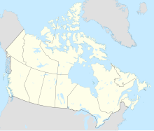
| Map | |||||||||||
 | |||||||||||
| Runways | |||||||||||
| |||||||||||
Source: Canada Flight Supplement[1] | |||||||||||
Salaberry-de-Valleyfield Aerodrome, (TC LID: CSD3), is located 2.5 nautical miles (4.6 km; 2.9 mi) southwest of Salaberry-de-Valleyfield, Quebec, Canada.
Airplane construction
In the early 2000s, M. Leger built a "Super Chipmunk" at CSD3. A memorial graving as been offered to the community by Aeroclub de Valleyfield members.[2]
Dropped pin
near Saint-Stanislas-de-Kostka, QC
https://goo.gl/maps/UkrfEyiqShx
See also
References
- ^ Canada Flight Supplement. Effective 0901Z 16 July 2020 to 0901Z 10 September 2020.
- ^ http://www.tsb.gc.ca/eng/rapports-reports/aviation/2002/a02q0098/a02q0098.asp


