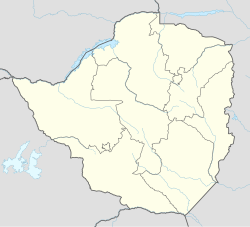
Mount Darwin, Zimbabwe
Mount Darwin | |
|---|---|
| Coordinates: 16°45′54″S 31°34′30″E / 16.76500°S 31.57500°E | |
| Country | |
| Province | Mashonaland Central |
| Districts of Zimbabwe | Mount Darwin District |
| Municipality | Mount Darwin Town Council |
| Elevation | 953 m (3,127 ft) |
| Population (2004 Estimate) | |
• Total | 6,350 |
| Climate | Cwa |
Mount Darwin is a town in Mashonaland Central province in Zimbabwe.
Location
The town lies in Mount Darwin District, in Mashonaland Central Province in north-eastern Zimbabwe. It is located approximately 160 kilometres (99 mi), by road, northeast of Harare, the capital and largest city in that country.[1]
Overview
In addition to the offices of Mount Darwin Town Council, the town is also the location of the Mount Darwin District Administration. The town has a public hospital, Mount Darwin District Hospital, and a mission hospital, Karanda Mission Hospital. Karanda attends to anywhere from 10 to 20 surgeries and between 200 and 300 outpatients daily.[2] ZB Bank Limited, a commercial bank, maintains a branch in the town.[3] Mount Darwin is also served by Mount Darwin Airport.
History
Mount Darwin is the probable site of some of the earliest European missionary work in southern Africa, by the Portuguese Jesuit Gonçalo da Silveira, who arrived in 1560 and was killed in March 1561 near Mount Darwin following a souring of relations with the local chief.[citation needed] Mount Darwin was named by the hunter and explorer Frederick Courtney Selous after the British naturalist Charles Darwin.
Climate
| Climate data for Mount Darwin, Zimbabwe (1961–1990) | |||||||||||||
|---|---|---|---|---|---|---|---|---|---|---|---|---|---|
| Month | Jan | Feb | Mar | Apr | May | Jun | Jul | Aug | Sep | Oct | Nov | Dec | Year |
| Mean daily maximum °C (°F) | 28.3 (82.9) |
27.9 (82.2) |
28.0 (82.4) |
27.6 (81.7) |
26.1 (79.0) |
24.0 (75.2) |
23.8 (74.8) |
26.2 (79.2) |
29.3 (84.7) |
31.5 (88.7) |
30.7 (87.3) |
28.8 (83.8) |
27.7 (81.9) |
| Mean daily minimum °C (°F) | 18.5 (65.3) |
18.4 (65.1) |
17.1 (62.8) |
14.3 (57.7) |
9.8 (49.6) |
6.6 (43.9) |
6.1 (43.0) |
8.1 (46.6) |
12.5 (54.5) |
16.7 (62.1) |
18.4 (65.1) |
18.5 (65.3) |
13.8 (56.8) |
| Average rainfall mm (inches) | 219.0 (8.62) |
185.9 (7.32) |
86.7 (3.41) |
28.9 (1.14) |
5.2 (0.20) |
0.9 (0.04) |
1.2 (0.05) |
0.5 (0.02) |
1.4 (0.06) |
10.3 (0.41) |
64.2 (2.53) |
183.4 (7.22) |
787.6 (31.01) |
| Average rainy days | 16 | 14 | 7 | 2 | 1 | 0 | 0 | 0 | 0 | 1 | 7 | 14 | 62 |
| Source: World Meteorological Organization[4] | |||||||||||||
Population
The current population of Mount Darwin is not publicly known. In 2004, the town's population was estimated at 6,350.[5] The next national population census in Zimbabwe is scheduled from 18 August 2012 through 28 August 2012.[6]
Notable people
The following notable people are associated with Mount Darwin:
- Joice Mujuru – A politician; she was born here
- James Makamba – A businessman; he maintains a home in Mount Darwin
- Savior Kasukuwere – A politician; he was born here.
See also
External links
References
- ^ Map Showing Harare And Mount Darwin With Distance Marker
- ^ "Hospital ministry". Karanda.org. Retrieved 20 February 2012.
- ^ List of Branches of ZB Bank Limited[permanent dead link]
- ^ "World Weather Information Service – Mount Darwin". World Meteorological Organization. Retrieved 13 May 2016.
- ^ Estimated Population In 2004
- ^ Next Population Census In Zimbabwe Scheduled For August 2012 Archived 5 December 2012 at archive.today

