Noshaq
| Noshaq | |
|---|---|
| Nowshak, Noshakh نوشاخ | |
 | |
| Highest point | |
| Elevation | 7,492 m (24,580 ft) Ranked 52nd |
| Prominence | 2,024 m (6,640 ft) |
| Listing | Country high point Ultra |
| Coordinates | 36°25′54″N 71°49′42″E / 36.43167°N 71.82833°E |
| Naming | |
| Native name | نوشاخ Error {{native name checker}}: parameter value is malformed (help) |
| Geography | |
| Location | Afghanistan |
| Country | Afghanistan |
| Province | Badakhshan |
| Parent range | Hindu Kush |
| Climbing | |
| First ascent | 1960 by Toshiaki Sakai and Goro Iwatsubo (Japan) |
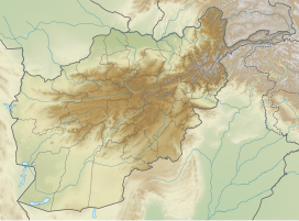
Noshaq (also called Nowshak or Nōshākh; Persian/Template:Lang-ps) is the second highest peak in the Hindu Kush Range (after Tirich Mir) at 7,492 m (24,580 ft). It lies on the border between Badakhshan Province in Afghanistan. It is the highest point in Afghanistan and is the world's westernmost 7,000 meter massif.
Noshaq was first climbed by a Japanese expedition in 1960 led by Professor Sakato. Other members of the expedition were Goro Iwatsabo and Toshiaki Sakai. The climb followed the normal Pakistan approach, the southeast ridge from the Qadzi Deh Glacier. The normal Afghanistan approach route is by the west ridge.
The first winter ascent was 13 February 1973 by Tadeusz Piotrowski and Andrzej Zawada, members of a Polish expedition, via the north face. It was the world’s first winter climb of any 7000 m peak. Until now it is the only winter ascent to this summit.
The main peak and Noshaq West (7250 m) are on the Afghanistan-Pakistan border lying within Pakistan but also bordering Afghanistan (the Durand Line), a watershed divide. The other peaks of this massif lie well within Pakistan. These all are easily accessible from Chitral, 64 km away. The west side of the massif is in Afghanistan whereas the south and eastern sides are in Pakistan. The second highest peak in this massif is Noshaq East (7480m), climbed in 1963 by Dr.Gerald Gruber and Rudolf Pischenger from Austria. The third highest peak of the massif is Noshaq Central (7400m) followed by Noshaq West. These peaks were also climbed by the same Austrian expedition of 1963.
The easiest access to Noshaq is from Chitral, Pakistan which is linked to Islamabad by flights which take 40 minutes. Alternatively a road trip from Pakistani capital Islamabad to Chitral takes about 11 hours and from the provincial capital Peshawar about 8 hours. The mountain is also accessible from Qazi Deh village in Afghanistan, 28km a journey of about five days. Qazi Deh is 280 km away from Kabul, Afghanistan.
The first Afghan ascent of the mountain was in July 2009. Two members, Malang Daria and Amruddin Sanjar, of a team of four Afghans, also including Afiat Khan and Gurg Ali - who turned around on the final stretch of their climb for health reasons - from the Wakhan Corridor summited on July 19.[1] In 2018 Hanifa Yousoufi became the first female Afghan climber to summit the mountain.[2]
See also
References
- ^ Afghan Noshaq expedition
- ^ Mary Turner. "First Afghan Woman Summits Her Country's Highest Peak". Outside Online. Retrieved 2018-08-24.
2. http://chitralexplorer.blogspot.com/2011/06/chitral-hidden-paradise-on-earth.html?m=1
External links

