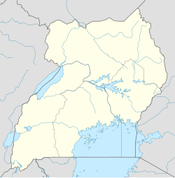
Kanoni
This article is actively undergoing a major edit for a little while. To help avoid edit conflicts, please do not edit this page while this message is displayed. This page was last edited at 20:26, 19 September 2018 (UTC) (6 years ago) – this estimate is cached, . Please remove this template if this page hasn't been edited for a significant time. If you are the editor who added this template, please be sure to remove it or replace it with {{Under construction}} between editing sessions. |
Kanoni | |
|---|---|
| Coordinates: 00°10′22″N 31°54′21″E / 0.17278°N 31.90583°E | |
| Country | |
| Region | Central Region of Uganda |
| District | Gomba District |
| Government | |
| • Member of Parliament | Mariam Najjemba |
| Elevation | 1,242 m (4,075 ft) |
| Population (2014 Census) | |
• Total | 12,439 |
| Time zone | UTC+3 (EAT) |
Kanoni, also Kanoni, Gomba or Kanoni–Gomba, is a town in the Central Region of Uganda. It is the commercial, administrative, and political headquarters of Gomba District.[1]
Location
The town is located in Gomba District, in the Buganda Region of Uganda, approximately 96 kilometres (60 mi), southwest of Kampala, Uganda's capital and largest city.[2] The town is located about 61 kilometres (38 mi), by road, west of Mpigi, the nearest large metropolitan area, along the Mpigi–Kabulasoke–Maddu–Sembabule Road.[3] The town lies at an average elevation of 1,242 metres (4,075 ft), above sea level.[4] The coordinates of Kanoni are 0°10'22.0"N, 31°54'21.0"E (Latitude:0.172778; Longitude:31.905833).[5]
Population
During the national population census and household survey, conducted on 27 August 2014, the population of Kanoni was enumerated at 12,439 people.[6]
Points of interest
The following points of interest lie within the town limits or close to the edges of town: (a) the tarmacked Mpigi–Kabulasoke–Maddu–Sembabule Road, passes through town, between Gombe and Kabulasoke.[5][7]
- Offices of Kanoni Town Council
- Headquarters of Gomba District Administration
- Kanoni Central Market
Notable people
See also
References
- ^ Independent Reporter (25 August 2010). "The making of a needy district" (Archived from the Original). The Independent (Uganda). Kampala. Retrieved 19 September 2018.
{{cite web}}:|archive-date=requires|archive-url=(help) - ^ Globefeed.com (19 September 2018). "Distance between Post Office Building, Kampala Road, Kampala, Uganda and Kanoni-Gomba, Uganda". Globefeed.com. Retrieved 19 September 2018.
- ^ Globefeed.com (19 September 2018). "Distance between Mpigi, Uganda and Kanoni-Gomba, Uganda". Globefeed.com. Retrieved 19 September 2018.
- ^ Geoview.info (21 August 2015). "Kanoni, Gomba District: Estimated Terrain Elevation Above Sea Level". Geoview.info. Retrieved 21 August 2015.
- ^ a b "Location of Kanoni, Gomba District, Buganda Region, Uganda" (Map). Google Maps. Retrieved 19 September 2018.
- ^ Uganda Bureau of Statistics (April 2017). "National Population and Housing Census 2014: Map 3: Distribution of Population by Sub-county; Gomba District, 2014" (PDF). Kampala: Uganda Bureau of Statistics. p. 10. Retrieved 19 September 2018.
- ^ a b Muwulya, Moses (19 September 2018). "Tarmacked road gives Bobi Wine town facelift". Daily Monitor. Kampala. Retrieved 19 September 2018.


