General José Antonio Anzoátegui International Airport
Appearance
General José Antonio Anzoátegui International Airport Aeropuerto Internacional General José Antonio Anzoátegui | |||||||||||||||
|---|---|---|---|---|---|---|---|---|---|---|---|---|---|---|---|
 | |||||||||||||||
| Summary | |||||||||||||||
| Airport type | Public | ||||||||||||||
| Serves | Barcelona, Venezuela | ||||||||||||||
| Elevation AMSL | 26 ft / 8 m | ||||||||||||||
| Coordinates | 10°06′26″N 64°41′21″W / 10.10722°N 64.68917°W | ||||||||||||||
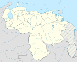
| Map | |||||||||||||||
 | |||||||||||||||
| Runways | |||||||||||||||
| |||||||||||||||
General José Antonio Anzoátegui International Airport (IATA: BLA, ICAO: SVBC) is an airport serving Barcelona, Venezuela. General Anzoátegui (1789–1819) was a Venezuelan Brigadier General during the Venezuelan War of Independence.
Facilities
Runway 02/20 length includes a 300 metres (980 ft) displaced threshold on Runway 20. Runway 15/33 length includes a 240 metres (790 ft) displaced threshold and 150 metres (490 ft) overrun on Runway 33. The Barcelona VORTAC (Ident: BNA) is located 0.36 nautical miles (0.67 km) off the threshold of Runway 15.[3]
Airlines and destinations
Passenger
| Airlines | Destinations |
|---|---|
| Avior Airlines | Caracas, Miami, Porlamar, Valencia (VE) |
| Conviasa | Maturín, Porlamar |
| LASER Airlines | Caracas |
| RUTACA Airlines | Caracas, Port of Spain |
Cargo
| Airlines | Destinations |
|---|---|
| Amerijet International | Barbados, Miami[citation needed] |
See also
References
- ^ Airport information for BLA at Great Circle Mapper.
- ^ Google Maps - Barcelona
- ^ BNA VORTAC
External links
![]() Media related to General José Antonio Anzoátegui International Airport at Wikimedia Commons
Media related to General José Antonio Anzoátegui International Airport at Wikimedia Commons

