User:Oceanflynn/Maps
{{Geobox|River|68.8960|-156.4582|type:river_region::US-AK}} | river_system = Colville River }}
38°53′21″N 77°02′55″W / 38.88922°N 77.04858°W
38.88929, -77.04855 http://geohash.org/dqcjnxwfw9j/style
38.88929 -77.04855 exact spot
N 38.88929 W 77.04855
38.88929° -77.04855°
N 38.88929° W 77.04855°
38°53.357' -77°2.913'
N 38°53.357' W 77°2.913'
38°53'21.44" -77°2'54.78"
N 38°53'21.44" W 77°2'54.78"
Closer to Memorial 38.88922, -77.04858
This is a user page for Oceanflynn. These maps are shareable web resources. I want to learn how to make useful maps for a number of articles. I have just downloaded NASA World Wind and will be working with Corel PaintShop Pro.
Duncan Lake Lake Amazay Lake in Sekani
-
Lake Amazay Lake in Sekani – is a natural 6 kilometres (3.7 mi)-long wilderness fish-bearing lake located at the headwaters of the Findlay watershed.
-
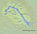
Map of the Finlay River, a tributary and headwater of the Peace River, in BC, Canada. 8 March 2010.

I added Duncan Lake (Amazay Lake) to the existing map of the 2010 Map of the Finlay River, a tributary and headwater of the Peace River, in BC, Canada. 8 March 2010. Background and river course data from http://www2.demis.nl/mapserver/mapper.asp, authored by Shannon. Duncan Lake, Amazay Lake in Sekani – is a natural 6 kilometres (3.7 mi)-long wilderness fish-bearing lake located at the headwaters of the Findlay watershed. This lake is the centre of the traditional land of the Tsay Keh Dene and is part of the three lake rich resource area Amazay/Thutade/ Kemess.
Historical Maps
-
"Map of the Periplus of the Erythraean Sea" by PHGCOM - self-made, background topographical map from Wikipedia Commons Image:Topographic30deg N0E60.png. Licensed under GFDL via Wikimedia Commons
The map of the Periplus of the Erythraean Sea is used in the article on the Incense Route.

This map is used in Timeline of the history of the region of Palestine.
I cropped this map and added a placename Beersheba. I have to establish location coordinates, categories, caption, information before uploading it to Wikimedia Commons. This town is on ancient trade routes.
Space Shuttle Columbia

In 2003 On February 1, 2003, the seven crew members of the Space Shuttle Columbia STS-107 were lost over North Texas. An STS-107 crew member on board the Space Shuttle Columbia took this picture. The roll of unprocessed film was later discovered by searchers in the are from the Space Ship debris.
Derivative maps

This image or video was catalogued by one of the centers of the United States National Aeronautics and Space Administration (NASA) under Photo ID: STS107-393-014. This map is used in Timeline of the history of the region of Palestine.


