Sathyagala
Sathyagala | |
|---|---|
Village | |
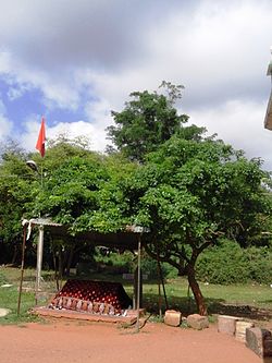
 Dargah at Sathyagala | |
 | |
| Coordinates: 12°09′N 77°06′E / 12.15°N 77.10°E | |
| Country | |
| State | Karnataka |
| District | Chamarajanagar |
| Talukas | Kollegal |
| Population (2001) | |
• Total | 12,503 |
| Languages | |
| • Official | Kannada |
| Time zone | UTC+5:30 (IST) |
Sathegala is a village in the southern state of Karnataka, India.[1][2] It is located in the Kollegal taluk of Chamarajanagar district.
Demographics
As of 2001[update] India census, Sathegala had a population of 12503, with 6518 males and 5985 females.[1]
Places of interest
Within one furlong of the handpost junction, there are two dargah on the road to Shivanasamudram waterfalls. The first one has a decorated in the open courtyard with three surrounding building and space for devotees to take rest and have food.
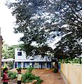
The second Dargah is set in a sylvan surroundings some two furlongs from the junction on the opposite side of the street. On the right hand side of the village school, there is a tree worship temple with a big and ancient tree besides it.

Nearby attractions
The Sivanasamudram Falls is on the Kaveri River after the river has wound its way through the rocks and ravines of the Deccan Plateau and drops off to form waterfalls.[3]
Schools
- Sathyagala School, Handpost junction.
- Government primary school, Agrahara
See also
Image Gallery
-
Sathyagala School
-
Dargah Gool rashan zameer
-
Dargah near school
-
Temple near school
References
- ^ a b Village code= 2926900 "Census of India : Villages with population 5000 & above". Registrar General & Census Commissioner, India. Retrieved 18 December 2008.
- ^ "Yahoomaps India :". Retrieved 18 December 2008. Sathegala, Chamarajanagar, Karnataka
- ^ "Shivanasamudra Falls".
External links


