Mount Shimbiris
Appearance
| Shimbiris | |
|---|---|
| Highest point | |
| Elevation | 2,460 m (8,070 ft)[1] |
| Prominence | 1,495 m (4,905 ft)[1] |
| Listing | Country high point |
| Coordinates | 10°44′09″N 47°14′42″E / 10.73583°N 47.24500°E |
| Geography | |
| Location | |
| Parent range | Ogo Mountains |
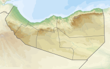
Mount Shimbiris is the highest peak in Somalia.[1] It has an elevation of 2,460 metres (8,071 ft) above sea level.[2] It is located in the Al Madow mountain range in northern Somaliland in the Sanaag region. SRTM data shows that its often-quoted elevation of 2,416 metres (7,927 ft) is slightly low.[1]
There is no vehicle access. However, visitors can stay in a tent. [3]
References
- ^ a b c d List of African ultras on Peaklist.org – Somaliland footnote SRTM value of 2,460 m elevation. Prominence figure is based on this elevation. Retrieved 27 September 2011
- ^ "Al-Madow Mountain Forest". SATG. Retrieved 15 May 2014.
- ^ "Mountain Forecast". Retrieved 27 January 2017.
External links

