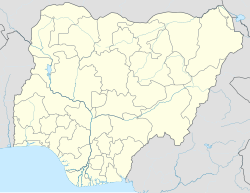
Amawom
Appearance
Amawom | |
|---|---|
Village | |
| Coordinates: 5°28′N 7°34′E / 5.467°N 7.567°E | |
| Country | |
| State | Abia State |
| Time zone | UTC+1 (WAT) |
Amawom is one of the 18 villages of the Oboro clan in the Local Government Area of Ikwuano in the Abia State. It has 9 hamlets including Mbakamanu, Agbommiri, Umuobia, Mbachukwu, Umuokom, Mgbaja, Agah, Mbaisara and Amaya. Mbakamanu is the biggest among all and produced the First eze of Amawom. The name is derived from two words "Ama" meaning location and "Awom" meaning farm. The present Amawom is believed to have been discovered in the 18th century.[citation needed] English and Igbo are the languages spoken in the village.[2]
References
- ^ "Amawom, Owerri, Owerri, Owerri, Imo: 460221". PostCodeBase.com. Archived from the original on February 27, 2016. Retrieved February 27, 2016.
- ^ "Amawom - Nigeria". Stad.com. Archived from the original on February 27, 2016. Retrieved February 27, 2016.
- "Amawom 3D map in Google Earth". Maplandia.com. Archived from the original on February 27, 2016. Retrieved February 27, 2016.

