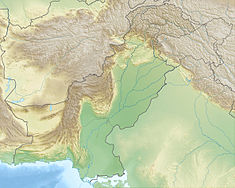
Kand Dam
Appearance
| Kand Dam | |
|---|---|
| Country | Pakistan |
| Location | North Waziristan Agency, FATA |
| Coordinates | 33°05′30″N 70°12′25″E / 33.09167°N 70.20694°E |
| Status | Operational |
| Construction began | 2011 |
| Opening date | December 2016 |
| Construction cost | PKR 198.145 million |
| Owner(s) | Government of Pakistan |
| Dam and spillways | |
| Type of dam | Embankment, rock-filled |
| Height | 23 m (75 ft) |
| Length | 200 m (640 ft) |
| Reservoir | |
| Total capacity | 4,163,000 m3 (3,375 acre⋅ft) |
| Catchment area | 53.7 km2 (20.75 sq mi) |
Kand Dam is small earth core rock-fill dam in North Waziristan Agency of FATA, Pakistan.
The construction of dam started in 2011 and was expected to be complete by September 2014 with projected cost of PKR 198.145 Million. Due to military operations, construction of the dam was suspended in June 2014 at 86% progress. It was eventually completed in December 2016.[1]
The dam has a height of 23 metres (75 ft) and a length of 200 metres (640 ft).[2] If completed, the dam would irrigate 290 hectares (716 acres) of land, with a total water storage capacity of 4,163,000 cubic metres (3,375 acre⋅ft), and a catchment area of 53.7 square kilometres (20.75 sq mi).[3]
See also
References
- ^ "FATA Development Authority » Kand Small Dam in North Waziristan Agency". Retrieved 2020-04-26.
- ^ FATA Development Authority » Kand Small Dam in North Waziristan Agency
- ^ Small dams to irrigate 2,688 acres of land in Waziristan – sohni dharti : sohni dharti Archived 2014-07-26 at the Wayback Machine

