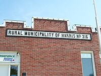
Rural Municipality of Harris No. 316

The Rural Municipality of Harris No. 316 (2016 population: 193) is a rural municipality (RM) in the Canadian province of Saskatchewan within Census Division No. 12 and SARM Division No. 5. The RM's office is located in the Village of Harris.
Demographics
In the 2016 Census of Population conducted by Statistics Canada, the RM of Harris No. 316 recorded a population of 193 living in 83 of its 95 total private dwellings, a -13.8% change from its 2011 population of 224. With a land area of 805.42 km2 (310.97 sq mi), it had a population density of 0.2/km2 (0.6/sq mi) in 2016.[1]
In the 2011 Census of Population, the RM of Harris No. 316 recorded a population of 224, a 14.9% change from its 2006 population of 195. With a land area of 805.42 km2 (310.97 sq mi), it had a population density of 0.3/km2 (0.7/sq mi) in 2011.[2]
Communities and localities
The following urban municipalities are surrounded by the Rural Municipality of Harris No. 316:
- none
- none
- none
The following hamlets are located within the Rural Municipality of Harris No. 316:
- none
- none
- none
Transportation
Attractions
- Leonard Farm Museum
- Crystal Beach Regional Park
- Crystal Beach Lake Prairie National Wildlife Area
- Prairie National Wildlife Area
- Harris Heritage Museum
See also
References
- ^ "Population and dwelling counts, for Canada, provinces and territories, and census subdivisions (municipalities), 2016 and 2011 censuses – 100% data (Saskatchewan)". Statistics Canada. February 8, 2017. Retrieved May 1, 2020.
- ^ "Population and dwelling counts, for Canada, provinces and territories, and census subdivisions (municipalities), 2011 and 2006 censuses (Saskatchewan)". Statistics Canada. June 3, 2019. Retrieved May 1, 2020.

