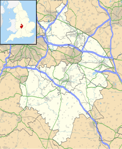
Thurlaston, Warwickshire
| Thurlaston | |
|---|---|
 Thurlaston Main Street | |
Location within Warwickshire | |
| Population | 368 (2011) |
| OS grid reference | SP477710 |
| Civil parish |
|
| District | |
| Shire county | |
| Region | |
| Country | England |
| Sovereign state | United Kingdom |
| Post town | RUGBY |
| Postcode district | CV23 |
| Dialling code | 01788 |
| Police | Warwickshire |
| Fire | Warwickshire |
| Ambulance | West Midlands |
| UK Parliament | |
Thurlaston is a village and civil parish in the Rugby district of Warwickshire, England. According to the 2001 census the parish had a population of 352, increasing to 368 at the 2011 census.[1]
Overview
Thurlaston was mentioned in the Domesday Book as Torlavestone.[2]
The village is located around 3.5 miles (5.6 km) south-west of Rugby, and around 1 mile (1.6 km) west of the larger village of Dunchurch. The M45 motorway runs immediately to the north of the village. Thurlaston is in a cul-de-sac location, there is only one road into the village from the north, connecting it with the B4429 via a bridge over the M45 motorway. Thurlaston overlooks the Draycote Water reservoir to the south and is close to the county border with Northamptonshire, less than 2 miles to the east.[3]
Notable buildings
The village church of St. Edmund is a red brick building dating from 1849 designed by William Butterfield. It is unusual in that it was designed to serve as both a church and a school with a schoolmaster's house attached, it is now grade II listed.[4] The most famous building, however, is probably the old 18th century windmill which is now used as a private house, this is also grade II listed.[5][3]
-
Old windmill at Thurlaston, now a house
-
St Edmund's Church
References
- ^ "THURLASTON Parish in West Midlands". City Population. Retrieved 4 November 2019.
- ^ "Warwickshire Q-Z". The Domesday Book Online. Retrieved 4 November 2019.
- ^ a b Geoff, Allen (2000). Warwickshire Towns & Villages. Sigma Press. p. 134. ISBN 1-85058-642-X.
- ^ "Church House church of St Edmund A Grade II Listed Building in Thurlaston, Warwickshire". British Listed Buildings. Retrieved 16 May 2020.
- ^ "The Windmill A Grade II Listed Building in Thurlaston, Warwickshire". British Listed Buildings. Retrieved 16 May 2020.
External links
- Thurlaston Parish Council website
- Thurlaston - page on Our Warwickshire


