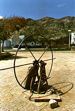
Brava, Cape Verde
see also Brava (Disambiguation)
| Brava | |
|---|---|

| |
| Elevation: | 976 m (3,202 ft) |
| Latitude: | 14.85 (14° 51' 0' N) |
| Longitude: | 24.71667 (24° 43' 0' W) |
| Location: | Cape Verde Islands |
| Range: | |
| Population: | around 7,000 |
| Area: | 64 km² |
| Type: | Stratovolcano |

Brava is a volcanic island in the Cape Verde group. It is the smallest inhabited island of Cape Verde, one of the Sotaventos. First settled in the 1540s, its population grew after Mount Fogo on neighbouring Fogo erupted in 1675. Its main industry was long whaling, but the island is now primarily agricultural. The island's main town is Vila Nova Sintra.
Volcanic activity on the island has been mainly located along three sets of lineaments, which all intersect at the crest of ground that forms the highest part of the island. Brava has no documented historical eruptions, but its youthful volcanic morphology and the fact that earthquake swarms still occur indicate the potential for future eruptions.
The municipality has no municipal boundaries which means it is encircled with the Atlantic Ocean.
Brava is the only inhabited island in Cape Verde without an active airport and was severely damaged by Tropical Storm Beryl in 1982. Former inhabitants of the island include Eugénio Tavares.
Parishes
Settlements
- Cachaço
- Campo Baixo
- Cova Joana
- Fajã de Agua
- Furna
- Lime Doce
- Mato Grande
- Nova Sintra do Monte
- Santa Bárbara
- Tantum
- Vila Nova Sintra
Geography
- Population: around 6,800 (1991), 4,296 (2001)
- Density: around 101.49/km²
- ISO 3166-2:CV: CV-BR
- Area: 67 km²
- Name of inhabitants: Bravense
- Municipality: Vila Nova Sintra (population: 1,500 1991, 1,882 2001)
It is part of the district of Sotavento. The places include Nova Sintra.
The island has schools, a lyceum, a gymnasia, churches, and a square (praça) including one in honor of the famous musician Eugene Tavares.
All of the five villages lie north of the mountaintop and has four main roads including Furna - Vila Nova Sintra and Fajã de Agua and south to Nova Sintra do Monte and slightly south of the mountaintop. The two large islands north of Brava are unhabited. The mountain valleys domimates the south, the east and the west. The north has a few valleys.
North of Brava are two small islands with 4 islets, 3 of them are west of Ilh(e)u de Cima. The islands are Ilh(e)u Grande (Portuguese for Large Island or Big Island) and Ilh(e)u de Cima.
The island is part of the Sotavento (Portuguese for islands under the wind) island chain and is located west of Fogo. Precipitation arrives from the trade wind clouds. It lies in the leeward of the enormous Fogo volcano. The island is covered with a leeward cloud so that the evaporation is smaller and the vegetation is enrich. The island is more closely settled The places include the village of Vila Nova Sintra. The village of Furna has a commercial port.
Geographical features
|
|
History
Brava was founded in 1462 by the Portuguese and the first settlement was founded in 1573. Slave trade was common in Cidade Velha. The persons that were from Madeira and Minho in Northern Portugal did not participate any longer. In 1680, the inhabitants fled to the nearby large island of Fogo after the volcano erupted and lava began to flow and devastate. In the 17th and the 18th centuries, pirates raided the bays of the island and continued until the 19th century when whale-catching was common from the ships of Europe and North America. Emigration began as the whale-catching ships sailed people from Brava to the northeastern part of North America especially along the Eastern Seaboard. Most of the immigrants from Brava settled in Boston, Massachusetts, Providence, Rhode Island and New Bedford, Massachusetts. Brava most famous son is the musician Eugénio Tavares, which he used the traditional morna and was written in Crioulo. A statue dedeciated to Eugene Tavares is in the main square of Vila Nova Sintra and is encircled with a beautiful garden that are filled with trees, sunflowers, flowers, grass and other types of plants. Other notable persons includes Hermano da Pina and Armando da Pina who lives in the Eastern Seaboard which has his ancestry to his parents in Brava.
Economics and Tourism
The main economy of the island are agriculture that relate with irrigation and fishing which are the island's main production. Trading and private households depend on income from Cape Verdean residents from North America.
The airline service went to an end in 2004. Brava never had tourism. Tourism slowly boomed. The island is not suitable for beach tourism since because the steep shoreline makes the island not having a lot of beaches.
Sites of interest
- Vinagre (Portuguese for Vinegar)
Sporting teams
External links
- caboverde.com
- University of Massachusetts - information and images from Brava
- Photos of Brava
- Map and aerial photos
- Street map: Street map from Mapquest, Aerial photograph from Microsoft Terraserver or Google
- Satellite images: Google - image not yet available
- Coordinates: 14°55′0″N 23°31′0″W / 14.91667°N 23.51667°W
- In German:
Template:Cape Verde/Islands Template:Cape Verde/Municipalities 14°55′N 23°31′W / 14.917°N 23.517°W
