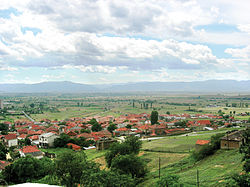
Varoš, Prilep
Appearance
This article needs additional citations for verification. (August 2016) |
Varoš/Varosh
Варош | |
|---|---|
Village | |
 Aerial view of the village | |
 | |
| Country | North Macedonia |
| Municipality | Prilep |
| Elevation | 650 m (2,130 ft) |
| Time zone | UTC+1 (CET) |
| Area code | +389/48/4XXXXX |
Varoš is a part of Prilep,[1] 20 years ago, this used to be a village, until it joined Prilep, making it the only former village in Prilep to be inhabited.
A legend says that in the past there were 77 churches.
